On March 11th, 2026 We Need Your Help!By Andy Cushen|2026-02-11T21:08:25-07:00February 11, 2026| Read More Comments Off on On March 11th, 2026 We Need Your Help!
In Defense of Flex Posts: The Aesthetic Benefits of Safe StreetsBy Andy Cushen|2026-01-03T13:54:35-07:00June 19, 2025| Read More 2
Transit Alternatives Must Be Studied before a Highway Expands in DenverBy Andy Cushen|2025-05-04T12:34:34-06:00March 3, 2025| Read More 4
New Projects with Public Input along the Speer Triangles and NoNo StreetsBy Andy Cushen|2025-06-19T09:37:55-06:00February 11, 2025| Read More 3
Could the Golden Triangle Ever Be “Denver’s Manhattan”?By Andy Cushen|2025-03-03T20:18:56-07:00November 27, 2024| Read More 2
Bus Rapid Transit for People Who Aren’t on the BusBy Andy Cushen|2024-11-27T18:38:33-07:00November 18, 2024| Read More 2
DenverUrbanism Podcast 6 & 8: Vision Zero for Denver and its SuburbsBy Andy Cushen|2024-11-27T18:41:09-07:00September 9, 2024| Read More 1
Denver’s Most Urban Census Tracts and Urban NeighborhoodsBy Andy Cushen|2024-03-29T09:02:02-06:00March 15, 2024| Read More 1
East Colfax Avenue BRT and the Problems of Auto-Centric Land UseBy Andy Cushen|2024-01-20T11:24:06-07:00December 3, 2023| Read More 1
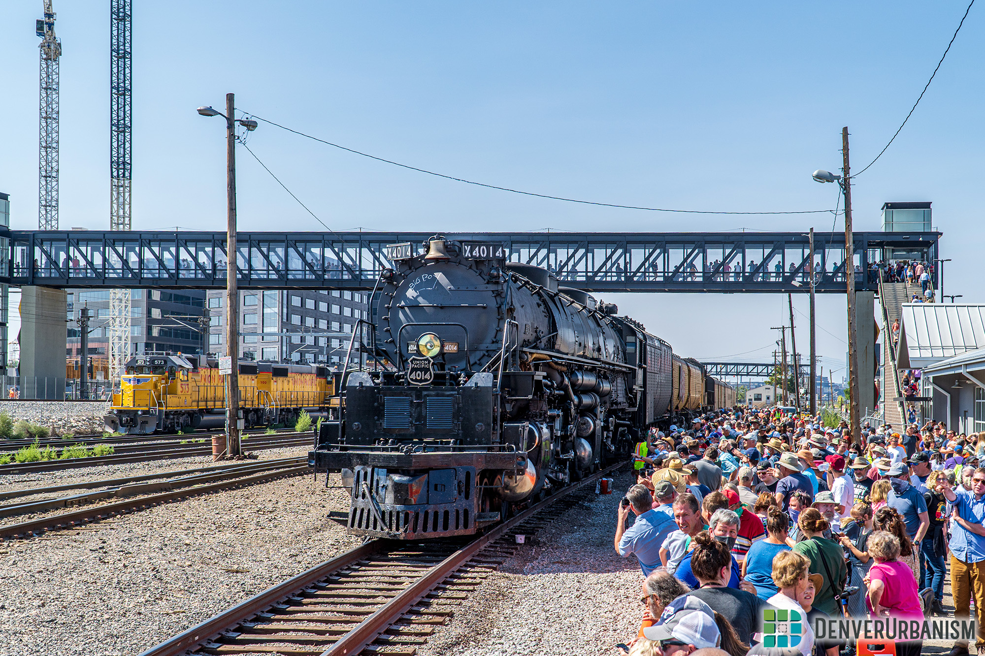
Union Pacific’s “Big Boy” No. 4014 Rolls Into Town Over Labor DayBy Ryan Dravitz|2023-11-20T15:47:04-07:00September 7, 2021| Read More 3
Tracking RTD’s Timeliness and Its Effects on the Typical PassengerBy Ryan Dravitz|2019-07-06T14:02:45-06:00May 14, 2019| Read More 7
I Rode My Bike From Southeast Denver to Golden—Here’s How It WentBy Loren Hansen|2018-11-04T17:45:46-07:00October 30, 2018| Read More 14
Denver Public Works Needs to Regulate E-Scooters Along Urban TrailsBy Loren Hansen|2018-09-23T15:29:59-06:00September 17, 2018| Read More 9
The “Last Mile” Isn’t Just a Transportation Problem but a Land Use One TooBy John Riecke|2018-08-21T12:10:53-06:00August 20, 2018| Read More 4
It Is Time to Start Making Denver a City of PedestriansBy John Riecke|2018-09-18T01:34:39-06:00November 19, 2017| Read More 11
Supporting Solutions for the Future or Fixing the Mistakes of the Past?By John Riecke|2017-08-02T15:15:09-06:00June 9, 2017| Read More 12
The Chicken or the Egg Debate is Actually a Red HerringBy Andy Sense|2017-04-05T13:22:52-06:00April 3, 2017| Read More 8
We’ve Built Denver Around Driving, But We Should StopBy John Riecke|2017-04-03T02:35:07-06:00April 1, 2017| Read More 2
Come Take a Ride on RTD’s Brand New R-Line!By Ryan Dravitz|2017-03-05T13:54:12-07:00March 3, 2017| Read More 2
Designing “Forgiving” Streets: There’s Nothing We Can Do. Or Is There?By Ken Schroeppel|2017-02-21T15:03:49-07:00February 11, 2017| Read More 2
Allocation of Street and Public Space Speaks to the Values of a CommunityBy John Riecke|2017-02-21T13:09:30-07:00February 3, 2017| Read More 2
Denver’s Smart City Ambitions Leverage Technology to Increase MobilityBy Ken Schroeppel|2016-12-22T17:44:17-07:00November 7, 2016| Read More 2
Do We Want Affordable Housing for People or Cars?By John Riecke|2017-02-21T13:10:31-07:00October 29, 2016| Read More 7
Denveright Update: Blueprint Denver Land Use and Transportation PlanBy Liz Munn|2016-12-27T16:06:11-07:00October 10, 2016| Read More 3
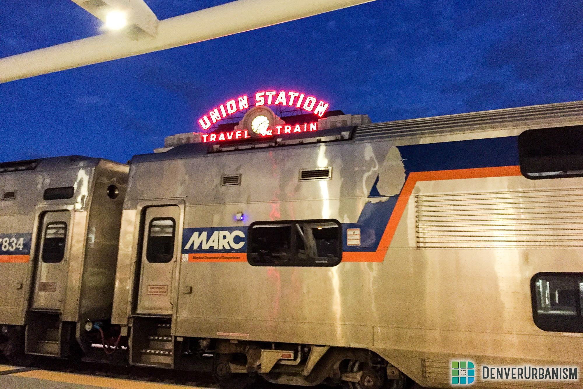
Why Washington, DC’s Commuter Train Was Parked at Denver’s Union StationBy Dan Malouff|2016-12-27T16:06:02-07:00October 7, 2016| Read More 4
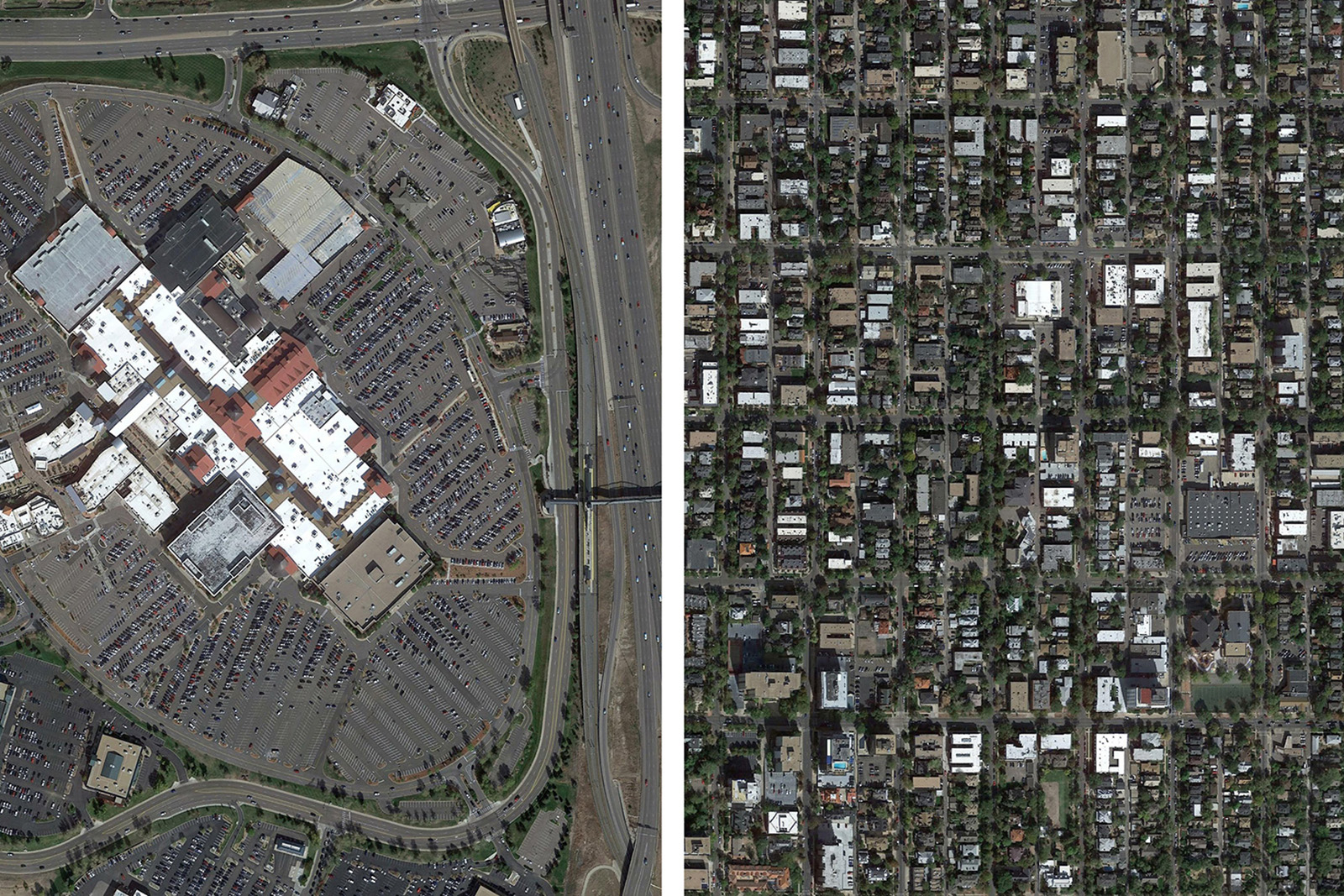
Parking Doesn’t Make a Good Place But People DoBy Ken Schroeppel|2016-12-27T17:04:34-07:00August 30, 2016| Read More 10
Denver’s Civic Center Station Reconstruction Gets UnderwayBy Ken Schroeppel|2016-12-28T15:40:01-07:00July 7, 2016| Read More 2
Denver Union Station Expands Bicycle InfrastructureBy Ken Schroeppel|2017-01-07T02:29:51-07:00May 13, 2016| Read More 5
FasTracks Progress: Denver International Airport StationBy Ryan Dravitz|2017-01-07T02:50:10-07:00April 27, 2016| Read More 5
Live.Ride.Share Denver 2016 – Coming May 17!By Ken Schroeppel|2016-12-27T17:30:23-07:00April 4, 2016| Read More Comments Off on Live.Ride.Share Denver 2016 – Coming May 17!