
Last week, RTD opened one of the final light rail lines in the current FasTracks plan. The R-Line, which primarily cuts through Aurora, contains 10.5 miles of new track while connecting to the existing track at the Nine Mile Station. The line itself runs from Lone Tree (Lincoln Station) to North Denver (Peoria Station) where it meets up with the A-Line. The R-Line will help connect Aurora to Denver International Airport and give those living in the Denver Tech Center and Lone Tree a shorter ride to the A-Line. The line also provides new options for Central Aurora residents to have a one seat ride to the Denver Tech Center and a two seat ride to Downtown Denver.
I started my journey at the Colorado Station. To catch the R-Line, you have to ride up to Belleview on the E / F-Lines, or take the H-Line and transfer between the Dayton and Florida Station.
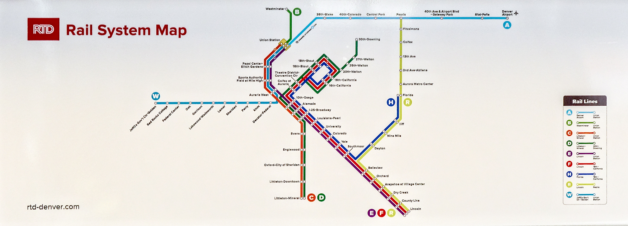
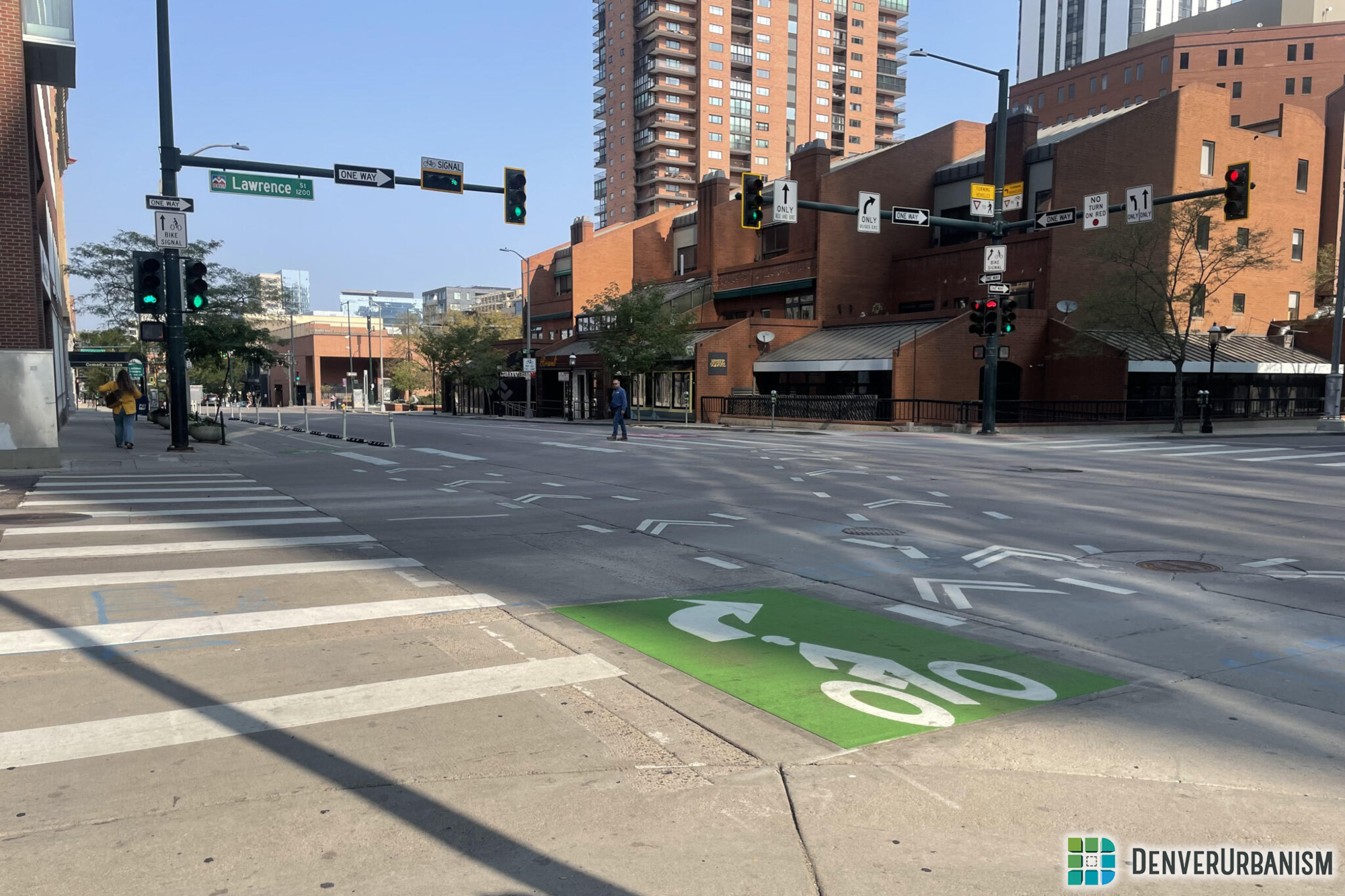
Let’s start out with a new rail system map I spotted on a train. Notice anything different? This refreshed map features straight lines which not only makes it easier to read, but is also much less confusing when trying to trace a route.
Starting at the Colorado Station, I took the first train that came to the station, an E-Line. That means I had to transfer at Belleview to catch the R-Line, pictured below. Once past Dayton and Nine Mile, well known H-Line stations, the next stop is the new Iliff Station. Iliff is a standard, small light rail station. The second picture below was taken during the short boarding time.


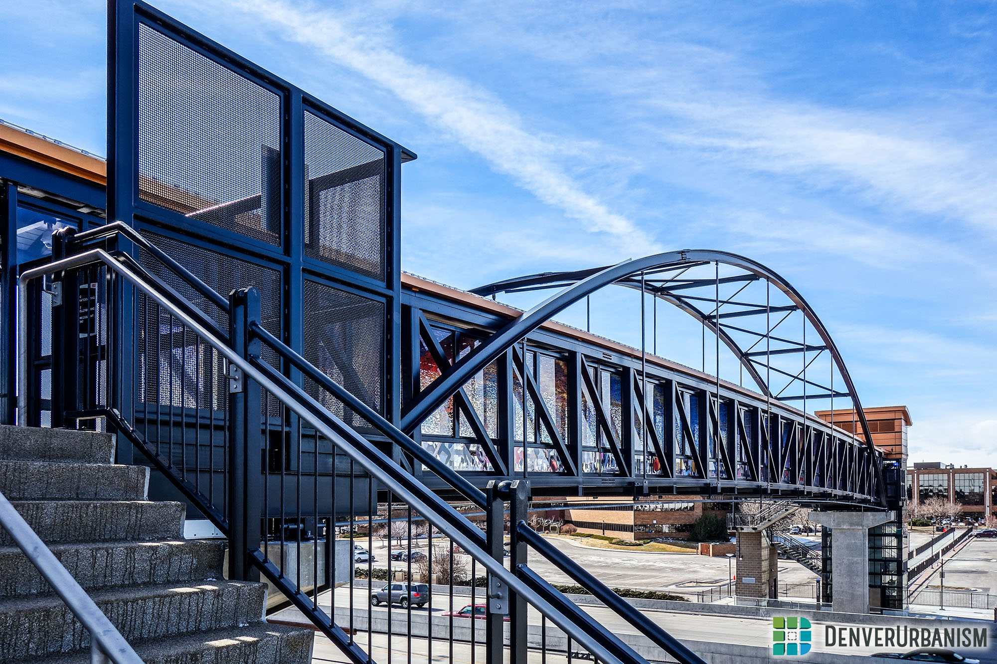
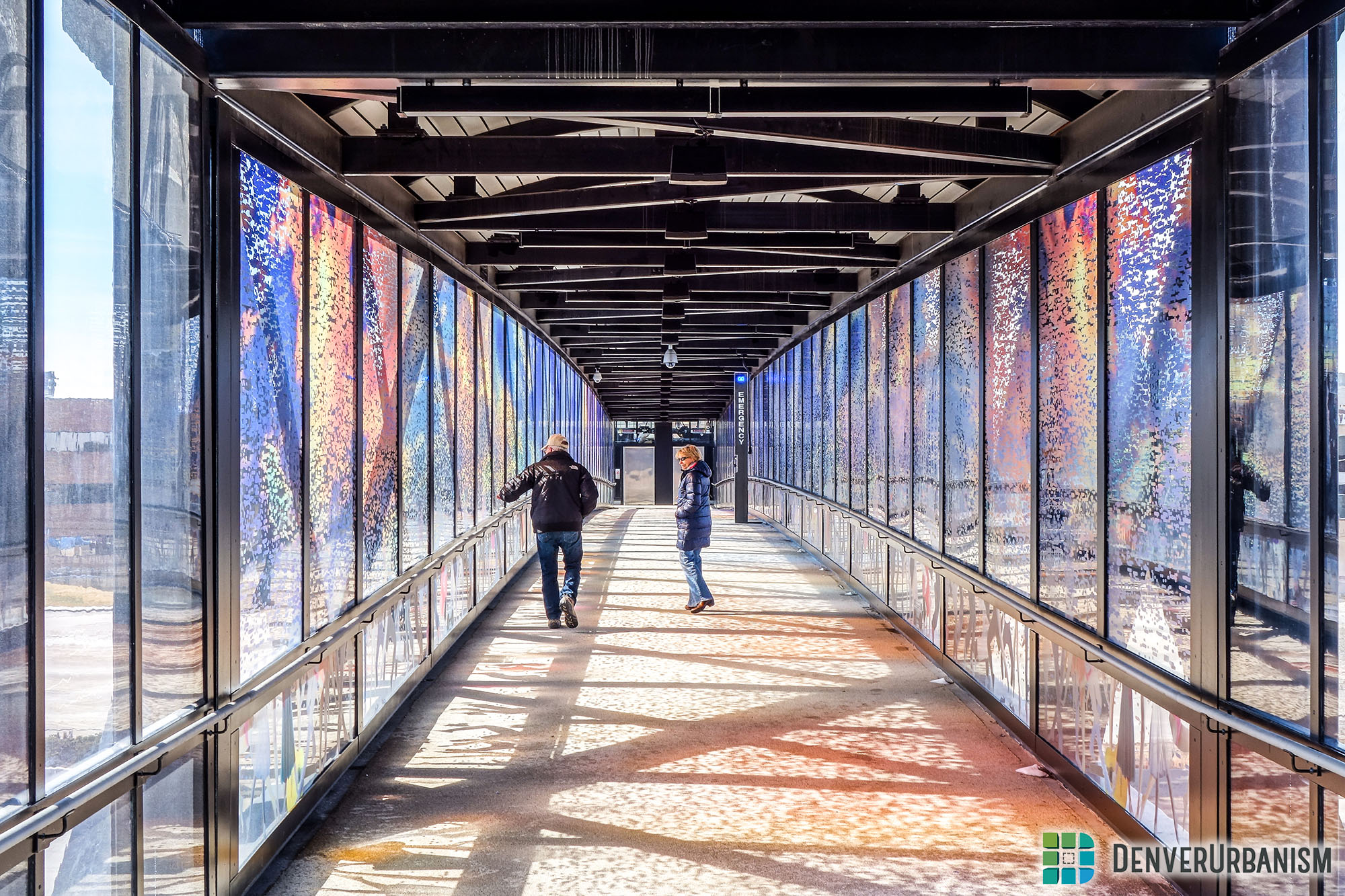
Moving right along, the next stop is Florida. This station features a pedestrian bridge going over Interstate 225, and is the end-of-line for the H-Line. To continue north from here, you have to board or be on a R-Line train.


As mentioned above, the pedestrian bridge crosses over Interstate 225 connecting the Medical Center of Aurora, my birthplace, to the Florida Station. Nostalgia aside, there is a particularly long pedestrian walkway, cutting through parking lots, and eventually ending at South Potomac Street.

After a hard right into the heart of Aurora, I noticed something completely new to Denver. The train was driving down the median of East Exposition Avenue. Wouldn’t this be a great concept for say, a streetcar line in Central Denver?

We have now arrived at our next stop, the Aurora Metro Station. Aurora Mall and City Center is across the street, with City Hall and Aurora Public Library nearby to the east. Infrastructure is still being put in place to connect City Hall and the library.


As lunch time came around, it was time to branch out from the train and go to Aurora City Center. It’s a fairly short walk, just over a block, but there is something very large separating Aurora City Center and the light rail line. Alameda and Sable is perhaps the largest intersection I have ever crossed in the Denver metro area. Hopefully pedestrian friendly improvements will be made but until then, this can be very intimidating for your average pedestrian wanting to use the rail amenity for the Aurora Mall or City Center.

The walk to the 2nd and Abilene, the station after Aurora Metro Center, was fairly short from Aurora City Center. This presented an opportunity to check out some of the infrastructure between the two stations. When the R-Line deviates from the highway, the train runs along both main and side streets. This does significantly slow down the train, but it acts more like a streetcar. However, at the moment, it comes with a price. There is no signal priority for the trains at any of the intersections. Because of this, an additional five or so minutes is added to the overall ride time causing frustration to any transit user.
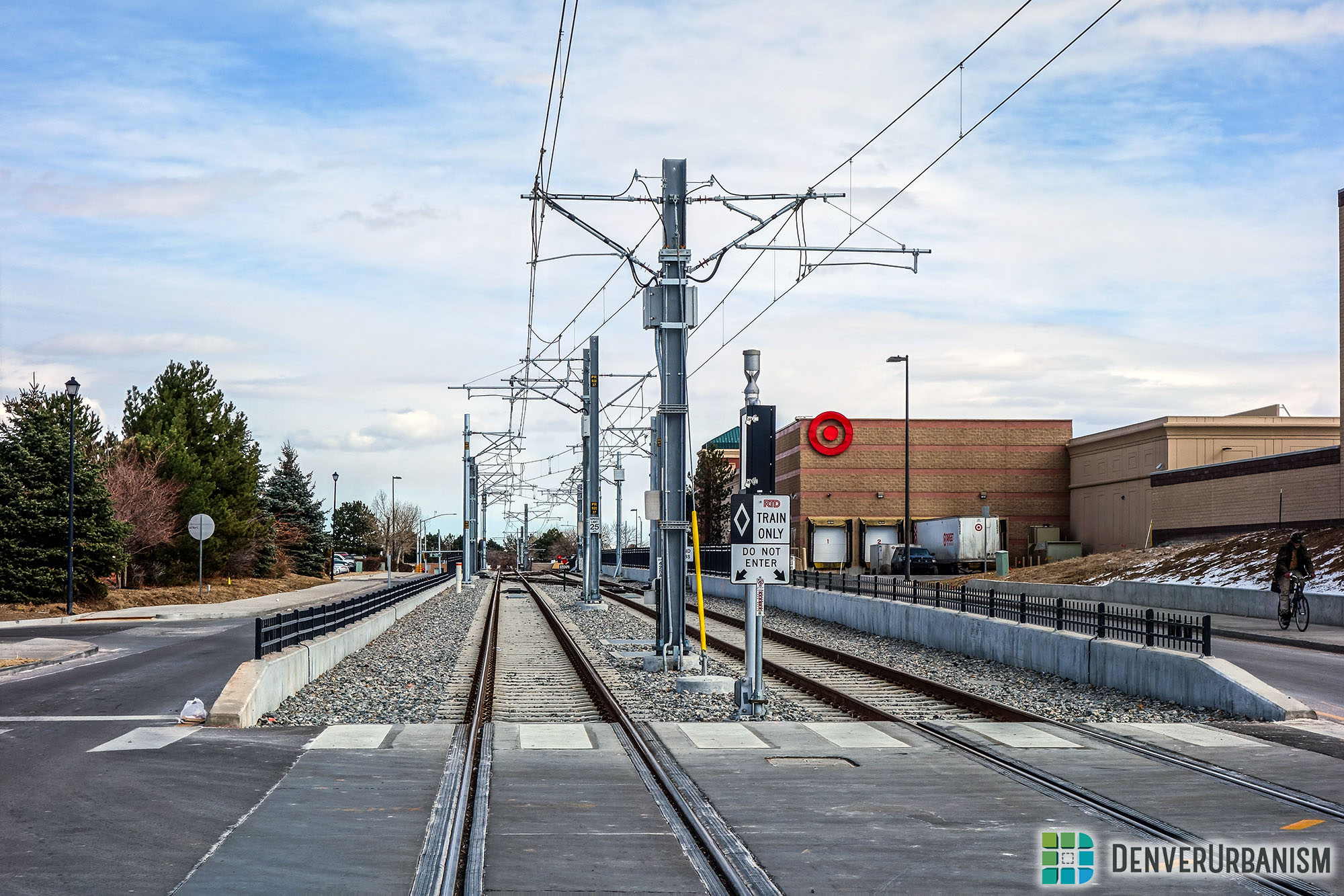

Walking towards the 2nd and Abilene Station, we can see that there is a lot of development opportunity in this vast open area; this is the case around most of the R-Line stations. A hotel project is currently underway at the north side of the station.


The 13th Avenue Station was strictly a park and ride with very little connectivity, including bus. After 13th Avenue comes the “signature” station along the line, the Colfax Station. This station is raised above Colfax and primarily serves Fitzsimons.

The station is accessed from Colfax, at the street level, with elevators and stairs bringing you up to the elevated platform.


Here are three additional photos of the Colfax Station.


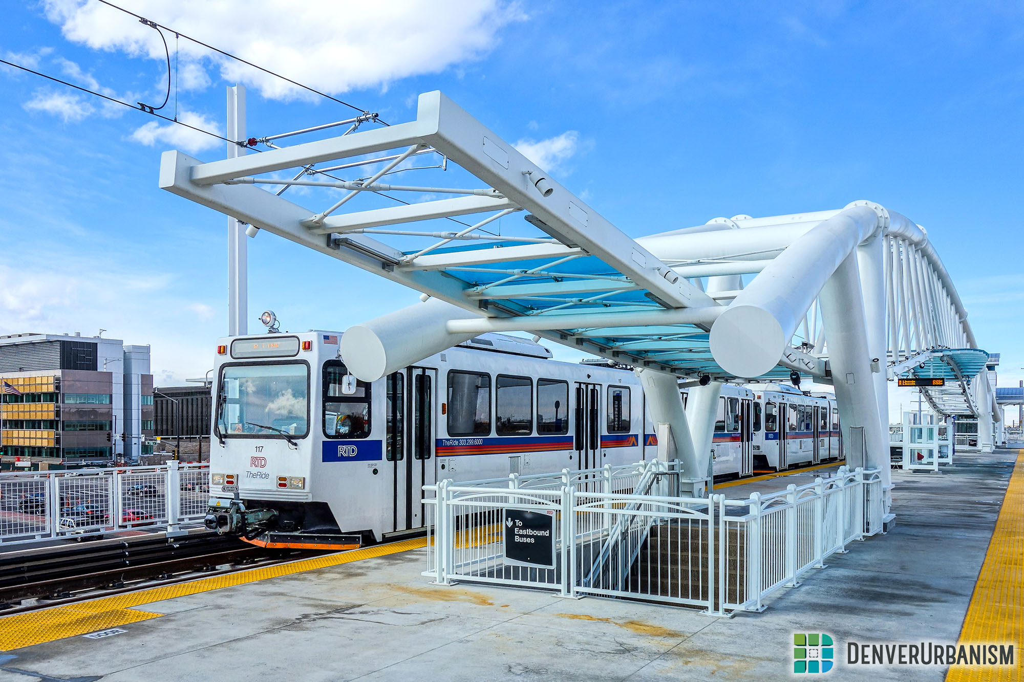
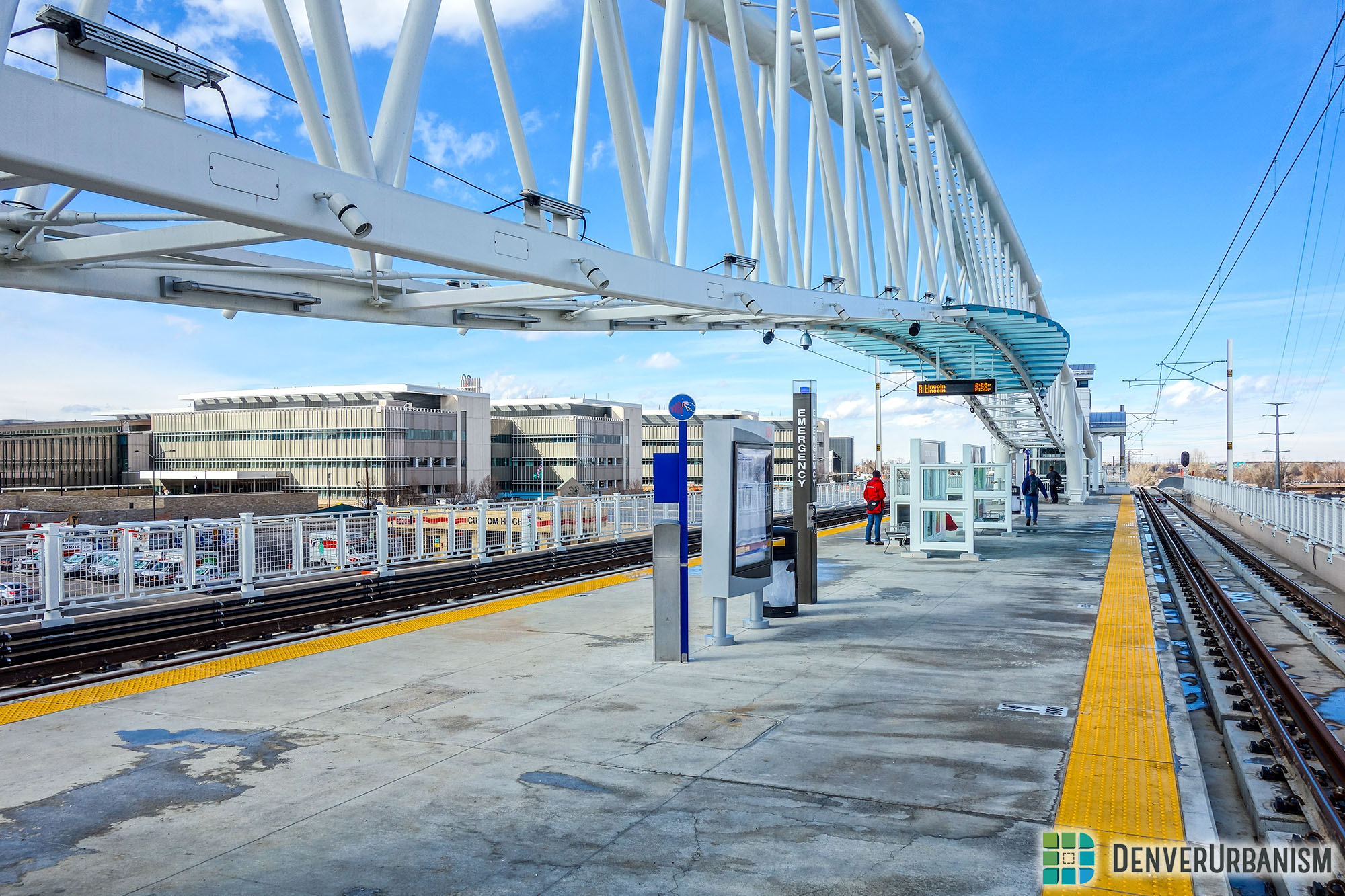
The Fitzsimons Station is located on the north end of Fitzsimons and is further away from Fitzsimons than the Colfax Station. Hopefully future development will close this gap. Last but not least, the R-Line ends at the Peoria Station. This is a unique station as it connects light rail to commuter rail (A-Line). Below is a panorama of the station.

Currently the timing between the R-Line and A-Line is a little tight. On Saturday, passengers had to run to catch the A-Line to avoid a 15 minute wait. This will hopefully be fixed in the near future.
Being a nerd of overhead catenary wire systems, it is really neat seeing both light rail and commuter rail technology at the same station.


As we mentioned throughout our ride, the R-Line has a lot of opportunities to grow into something great. As time goes on, development around the stations will help connect residents to vital infrastructure, such as sidewalks and bike paths, and enable them to use the amenities light rail has to offer.
Signal priorities at intersections, prioritizing transit over automobiles, would be a great start that can be fixed before development goes in. Given that it already takes 35 minutes to get from the Peoria Station to Nine Mile and just over an hour to get from the Peoria Station to the Colorado Station, every minute counts.
Quickly expanding on that point, when using Google Maps at the Peoria Station, riding the bus and driving came up as significantly quicker options to get me to my originating station even with the R-Line right in front of me. Again, every minute counts.
Thank you for taking a ride on the R-Line with us today!


An excellent, insightful report, Ryan! Your photos and commentary really take us for a ride into the future. I especially like your “streetcar” elements, showing how rail mixes at-grade with driving lanes for cars. This blend of transportation modes is the model for Denver’s future transit grid, with streetcars along the big streets. Harder for cars in some places, yes — but so much better for walkers and bikers.
No doubt you noticed how the older-model Siemens RTD rail cars — which don’t meet current ADA standards — make wheelchair and bike entry difficult, if not impossible. As we all know, boarding RTD light rail means “three steps up,” like boarding a conventional bus. Descriptions of eventual streetcar designs from both RTD and City of Denver plans make references to “low floor” rail cars, which make sidewalk-level boarding easy for pedestrians, bikes and wheelchairs. But the fact that RTD’s current light rail trains are being designed into street grids is a big step towards a state-of-the-art streetcar system for all of Denver.