Part 7 of our RiNo Infrastructure series focuses on the proposed RiNo Pedestrian Bridge over the South Platte River. Previous posts in this series include RTD’s 38th & Blake Station followed by Part 1: 35th Street Pedestrian Bridge, Part 2: 38th Street Pedestrian Bridge, Part 3: Brighton Boulevard Reconstruction, Part 4: River North Park, Part 5: Delgany Festival Street, and Part 6: River North Promenade.
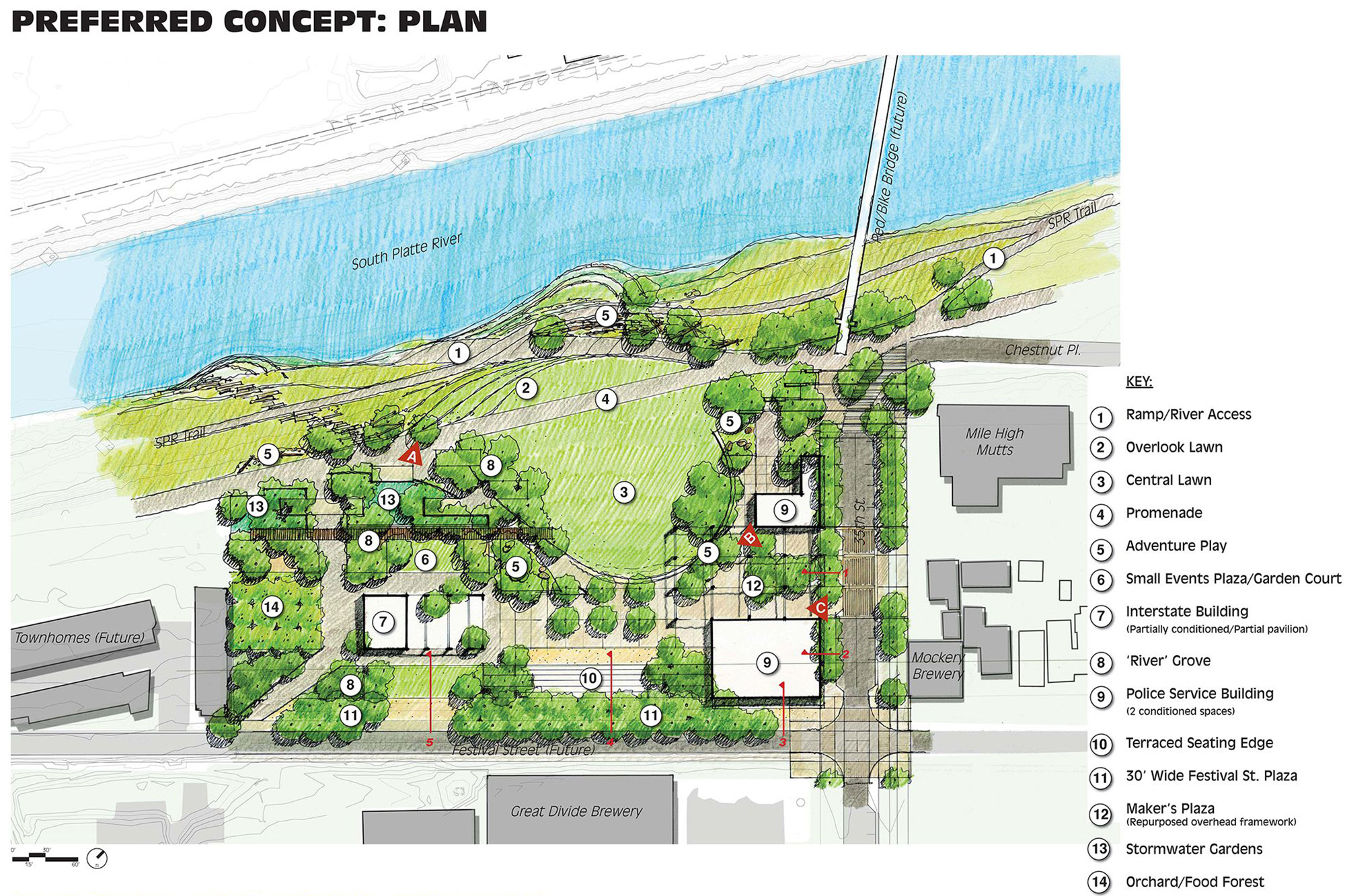
Denver’s River North district generally consists of three major areas: the area west of the South Platte River, the area between the river and the Union Pacific/RTD railroad tracks, and the area east of the railroad tracks. Much like how the 35th and 38th Street pedestrian bridges help connect the middle and eastern parts of RiNo together, the proposed RiNo Pedestrian Bridge over the river will help connect the middle and western parts of RiNo. The RiNo Pedestrian Bridge will be built at the foot of 35th Street, as can be seen in this diagram on the planned River North Park:
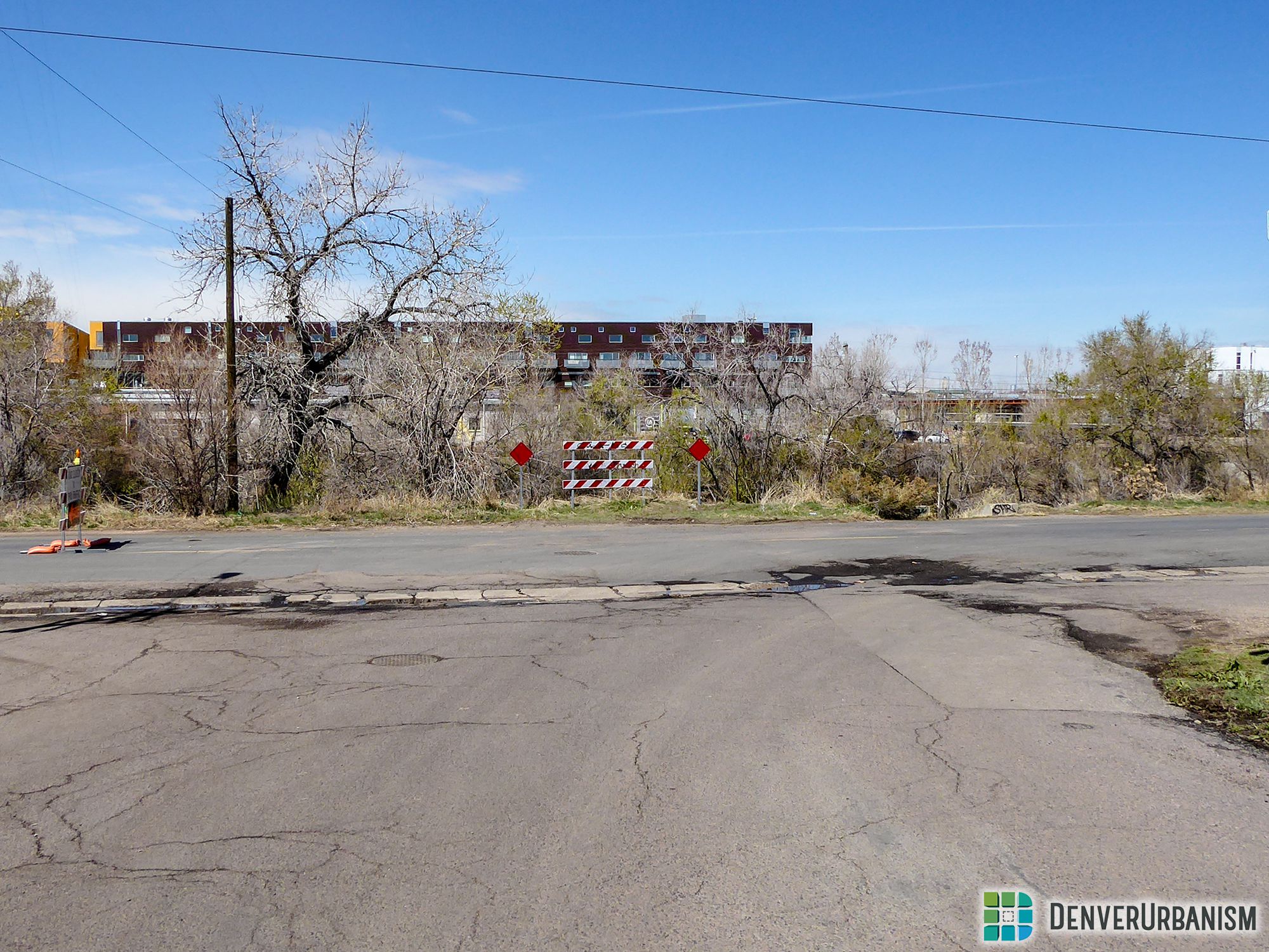
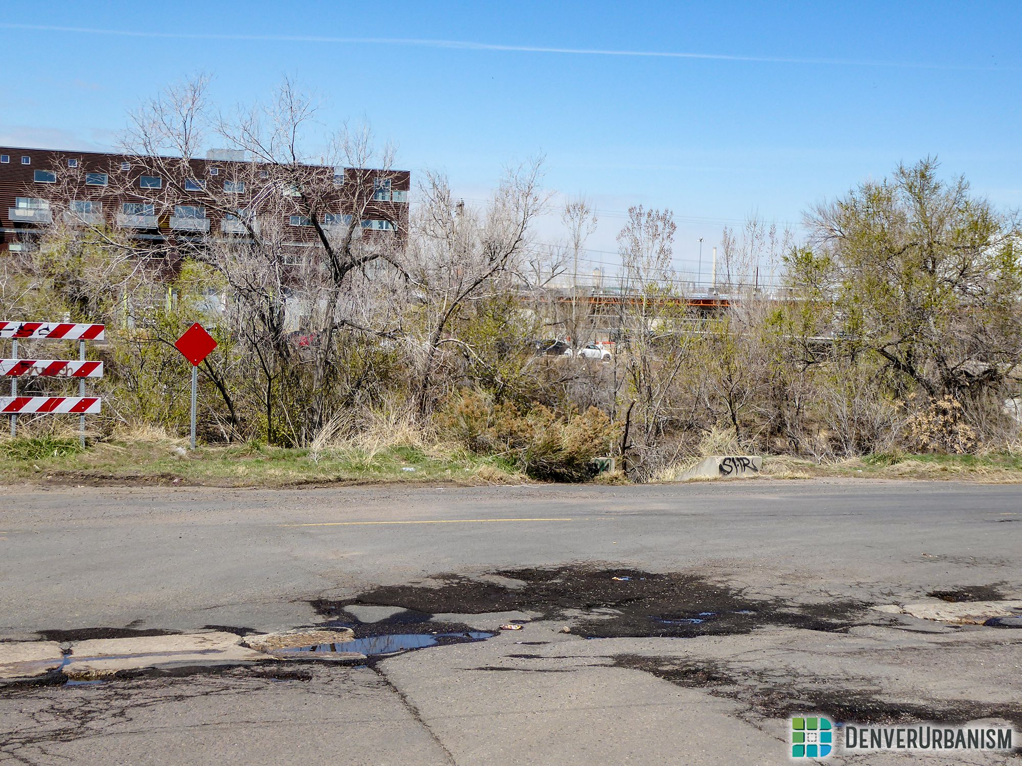
These photographs show the proposed approximate location of the bridge’s eastern end at Arkins Court and 35th Street:
The city recently started preliminary (30%) design for the RiNo Pedestrian Bridge after receiving public input over the past year or so through several public meetings and web surveys. The design work is being paid for by the North Denver Cornerstone Collaborative and the city’s Office of Economic Development and should be finished by the end of the summer. Having a preliminary design will then allow for cost estimates to be made and for fundraising to begin to help pay for the bridge’s construction. Completion of the 100% design is targeted for 1st Quarter 2017, while fundraising will continue throughout the year. Ideally, sufficient money will be raised by the end of 2017 to allow for bridge construction to begin in 2018.
Based on cost, constructability, and public input, a suspension bridge is the type of bridge chosen for this project. Designing and building the RiNo Pedestrian Bridge is a public/private/non-profit partnership, with the City representing the public sector, Zeppelin Development and potentially other RiNo property owners and businesses representing the private sector, and Bridges to Prosperity representing the non-profit sector. The image below, courtesy of Bridges to Prosperity, is an example of a suspension-type pedestrian bridge they helped construct in Nicaragua. While the RiNo bridge will be shorter and not necessarily the same design as this example, it illustrates the basic bridge type proposed for River North.
The RiNo Pedestrian Bridge will not only help connect the different parts of RiNo to each other, but it also will provide an important bicycle and pedestrian connection for the Globeville neighborhood. Located west of the river and north of the Burlington Northern rail yards, getting from Globeville to River North by bicycle currently isn’t easy, as Washington Street/38th Street are rather automobile-heavy, bike-unfriendly roadways. In the future, bicyclists will be able to head south from Washington Street while still on the west side of the river and cross over using the RiNo Pedestrian Bridge, providing direct access to the new River North Park and the 38th and Blake Station via the proposed 35th Street Woonerf (the topic of our next post in this series!) and the under-construction 35th Street Pedestrian Bridge.
Additionally, the Denver Public Library, a strong advocate for the new RiNo Pedestrian Bridge, is planning to have a special facility in the proposed River North Park, so the new bridge will provide nice access to their new facility for Globeville residents.
The RiNo Pedestrian Bridge will be an important new link in Denver’s expanding infrastructure designed for people, not just cars.


This is a great plan and I am very excited about this new bicycle/pedestrian connection and generally the new River North Park.
Although I do have one question. Because of the no camping laws downtown (technically everywhere but only really enforced downtown), this part of the Platte has become the main camping area for Denver’s homeless. Anyone who has ridden their bike along this part has seen the numerous tents and camping areas created by the homeless. Is there a plan to find housing for this population in the area? Or what generally does the city and the developers plan for helping the homeless likely displaced (again) by this project?
I like the connection, but it seems to me that this bridge so disproportionately benefits the Zeppelins as the only real land owner west of the river. Hopefully they are kicking in a big chunk!
I agree but I think that by the time the Zeppelins development is fully built out, it will be a significant neighborhood and warrant having a bridge over the river.