Denver’s River North district is booming with both private-sector development and public investment in transportation facilities and public spaces. So far in our series looking at RiNo’s new infrastructure, we’ve had a FasTracks update on RTD’s 38th & Blake Station, followed by Part 1: 35th Street Pedestrian Bridge and Part 2: 38th Street Pedestrian Bridge. In Part 3, let’s take a look at the reconstruction of Brighton Boulevard.
Brighton Boulevard was named, as you probably guessed, for its destination: the community of Brighton located in Adams County approximately 20 miles northeast of Downtown Denver. South of 46th Avenue/Interstate 70, Brighton Boulevard follows the alignment of Wewatta Street on the downtown grid. North of the highway, Brighton Boulevard heads north through the Elyria-Swansea neighborhood before veering northeast and running along the east side of the South Platte River into Commerce City. Then it gets weird. At 69th Avenue, Brighton Boulevard becomes a service road along the west side of Vasquez Boulevard and eventually dead-ends at O’Brian Canal near 80th Avenue. However, back at 72nd Avenue, the service road along the east side of Vasquez picks up the name Brighton Road, which continues another 12 miles into Brighton and ends at Bromley Lane. So, between 72nd and 80th Avenues, there’s both a Brighton Boulevard and a Brighton Road running parallel to each other.

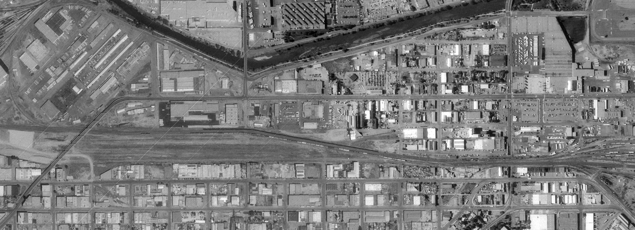
Near 80th Avenue in Adams County, Brighton Boulevard (left) dead-ends at O’Brian Canal while Brighton Road (right) continues on to Brighton. Source: Google Maps
Before we get to the reconstruction of Brighton Boulevard, let’s look at the street’s history!
The stretch of Brighton Boulevard in today’s RiNo was platted as part of different subdivisions from the mid-1870s through the early 1890s. The first segment of Brighton Boulevard, located between 38th and 44th Streets, was laid out as part of St. Vincent’s Addition of 1874 and was appropriately named St. Vincent Street. Developed by Catholic Bishop Joseph Machebeuf, the St. Vincent’s Addition reserved eight blocks of land between 39th and 41st Streets for a hospital to be known as St. Vincent’s Home. The hospital building’s foundation was completed but the project never made it any further and was abandoned.
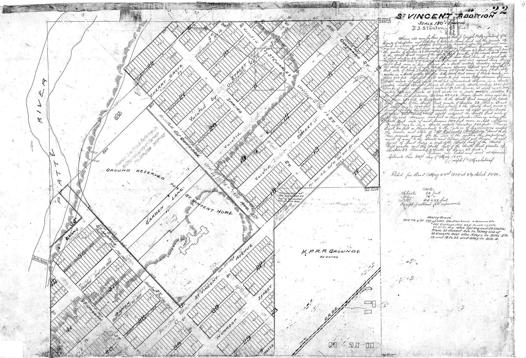
St. Vincent’s Addition of 1874 plat map. Source: City and County of Denver
In 1881, the next section of Brighton Boulevard, roughly between 34th and 38th Streets, was platted as part of the Ironton subdivision of January 1881 and the Ironton First Addition of June 1881. The “Ironton” name was appropriate, for throughout the two Ironton subdivisions (and St. Vincent’s Addition too), several smelters and foundries were developed. Business such as Rocky Mountain Ore Production Works, Denver Rolling Mill, Colorado Iron Works (where The Source is today), Denver Ore Sampling Works, and the Grant Smelter Works dominated the area during the 1880s. By 1882, St. Vincent Street had been renamed Wewatta Street.

Portion of Rollandet’s Map of the City of Denver, September 1885 showing Wewatta Street (now Brighton Boulevard) and industrial uses in the St. Vincent’s and Ironton subdivisions. Source: Denver Public Library, Western History Collection.
In the 1880s, the area was still largely undeveloped except for the industrial uses noted above, which were mostly found southwest of 34th and northeast of 41st. However, single-family homes on 25-foot lots were starting to sprout up in the area by the late 1880s. Robinson’s Atlas of 1887 shows several small houses scattered mostly along Wewatta and Delgany. Wood houses are color-coded as yellow and brick houses are pink. Just for fun, I’ve cropped a current Google Earth aerial image to the same extent as the Robinson map:

Portion of 1887 Robinson Atlas showing small homes along Wewatta and Delgany with comparison to a 2015 aerial photo of the same extent. Sources: Denver Public Library, Western History Collection; Google Earth.
Many of the houses along Delgany Street between 36th and 38th Streets are still around and used as residences. Several others in the area have been converted to commercial uses.

Small homes from the late 1800s remain along the 3600 block of Delgany. Source: Google Street View.
During the 1800s and early 1900s, the area was fairly isolated by the Union Pacific railroad tracks, with the primary connection into the neighborhood via 38th Street. Connections to the rest of the city improved, however, in the early 1920s with the completion of the controversial Broadway Extension project that pushed Broadway north from its then-terminus at Welton Street and across the diagonal downtown street grid to Blake Street, where a new viaduct took Broadway over the railroad tracks and curved northeast to connect to Wewatta Street. This image of a document from the late 1910s promoting the Broadway Extension shows the proposed path of Broadway.

Promotional material for the Broadway Extension project, late 1910s. Source: Denver Public Library, Western History Collection.
With the completion of the Broadway Extension project, Wewatta Street was renamed Brighton Boulevard by the Denver City Council in 1924.
The mix of industrial and residential uses in the area continued into the 1930s. Here is an aerial from 1933 showing the Brighton Boulevard corridor. Note the mix of single-family homes and gritty industrial/railroad uses. This is a big image—click, zoom, and scroll!

1933 aerial photograph showing a mix of industrial and residential uses along the Brighton Boulevard corridor. Source: City and County of Denver.
Into the post-WWII era, the residential uses were mostly overtaken by light industrial, commercial, and automobile-related uses. This 1992 aerial photo, cropped to the same extent as the 1933 aerial above, shows the loss of much of the 19th century housing in the area.
1992 aerial photo of the Brighton Boulevard corridor showing increased industrial and commercial uses and fewer residential uses compared to earlier in the century. Source: City and County of Denver.
Given the gritty, industrial nature of the Brighton Boulevard corridor and its relative isolation from the rest of the city, the area received virtually no infrastructure improvements from the city over many decades. Denver was content to allow Brighton Boulevard and its adjacent blocks to suffer with poor lighting and storm water drainage and a complete absence of sidewalks, curb, and gutter. This is the streetscape that still exists along Brighton Boulevard today:

The lack of standard urban infrastructure elements like curbs, gutters, and sidewalks have defined the Brighton Boulevard streetscape. Source: Google Street View.
That condition is about to change dramatically, and soon! With hundreds of millions of dollars of new development reshaping the River North area, the city is moving forward in 2016 with a complete reconstruction of the corridor’s infrastructure, paid for by $25 million in city funds (part of the North Denver Cornerstone Collaborative) and several million dollars from local property owners who voted to raise their taxes through a Business Improvement District and a General Improvement District to fund important upgrades to the project.
The new Brighton Boulevard will include a completely rebuilt street in concrete; new curb, gutter, and storm water drainage; new traffic signals, crosswalks, and intersection designs; wide sidewalks and vertically separated cycle tracks in both directions; buried utilities and new street and pedestrian lighting; and landscaping, wayfinding signage, and public art.
The best way to get a sense for what the new Brighton Boulevard will be like is to watch the following video, courtesy of the North Denver Cornerstone Collaborative and RNL Design, who produced the video.
Construction should begin later this year and be complete in 2017.
In Part 4 of our RiNo Infrastructure series, we will take a look at the plans for the new River North Park.


Very cool Kenny. The maps are amazing!
It’d be nice to see some money pumped into languishing streets (like 13th Ave through Cap Hill) rather than car-centric places fully detached from the rest of the city.
This looks awesome, and will be an amazing street once it’s complete. One question — will the bike lane be protected? I hope the city is considering a physical separation between cars / bikes + peds. Planters or trees in a median separating slower modes of transport from the busy road would be a wonderful addition.
The bike lanes are protected in that they are vertically higher than the street, as in, the bike lanes are above the curb.
Right on!
Great article! I worked in that area for many years and I would drive around early on Sunday mornings before work and take in all the surviving historical artifacts.
The maps and photos really pull it together, thanks.
Ken, your historic pieces are great!
Carefully read the Pro-Broadway Extension propaganda in the boxes around the 1910s map, and you’ll hear familiar echoes from the Fifties and Sixties, when the Denver Urban Renewal project was being promoted by similar interests — all in the name of improving Denver for the greater good.
Then drive along North Broadway (my term) and look at the lasting results of mass bulldozing: surface parking lots, hundreds of homeless people, clustering around off-downtown shelters, in an area still almost as grimy as the connected industrial zone along Brighton Boulevard.
Fast-forward a hundred years, and we see so-called “Arapahoe Square” straddling Broadway, finally evolving into an urban neighborhood, after twice being clobbered by “progress,” both times by inside special interests, manipulating city government through Eminent Domain and massive land deals.
Despite the obsession of Denver NIMBYS for down-zoning and height restrictions, more enlightened leadership is now better-focused on what urban government can do best — street improvements. Brighton Boulevard can become a great, walkable, bike-able thoroughfare, with this great new vision.
Great piece, Ken — and you’re showing us a concrete example of what the new Urbanism is all about. Now, if we can just see the same kind of approach to North Broadway…
On the Google map of the Commerce City portion of Brighton Blvd.the reason the road splits is because Brighton Road is the original route out of the city into Brighton and the dead end section at the O’Brian Canal is the first alignment of US Highway 85., Brighton Road of course predates US 85.
Thanks Steven!