Up next in our series examining the infrastructure investments supporting the River North area’s transformation as a thriving mixed-use arts district: Delgany Festival Street. Previously we’ve looked at RTD’s 38th & Blake Station followed by Part 1: 35th Street Pedestrian Bridge, Part 2: 38th Street Pedestrian Bridge, Part 3: Brighton Boulevard Reconstruction, and Part 4: River North Park.
The Delgany Festival Street is a new city street planned for where Delgany Street would be between 33rd and 35th streets. However, 33rd Street in this part of RiNo doesn’t exist, so a short stretch of 33rd Street will also be built as part of the project. Let’s get you oriented with the location of the new 33rd Street and Delgany Festival Street:
(Note: Currently, the proposed street is referred to on all the city documents I’ve seen as just “Festival Street.” I doubt that will be the street’s final name as it would be inconsistent with the city’s street-naming convention. So for now, I’m calling it “Delgany Festival Street” until an official name is finalized.)
Why isn’t there a 33rd Street on either side of Brighton Boulevard? What happened to Delgany southwest of 35th Street? While we’re at it, where is 34th Street? It all goes back to subdivision plats and right-of-way vacations and other fun planning things. Time for a little history…
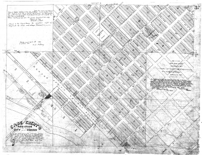
In addition to the Ironton and St. Vincent subdivisions, the other subdivision that contributed a small part to the RiNo urban fabric was Case and Ebert’s Addition of 1868—Denver’s first subdivision outside of downtown. A small part of Case and Ebert’s extended north of the railroad tracks, but the only streets platted in this area were Wynkoop and short sections of Wazee, 29th, 30th, and 31st. Not included were 32nd, 33rd, or 34th streets, as large iron mills and foundries occupied the space where these streets would have gone.
By 1871, the expansion of the Denver Pacific Railway grounds caused all of these streets except for 31st Street to be vacated, as the city engineering quarter-section map below shows.
As part of the Ironton 1st Addition, a short segment of 34th Street was platted between Delgany and Chestnut, but south of Delgany, 34th was never laid out due to a large wedge-shaped exclusion in the subdivision’s southwestern boundary. The subdivision map below also shows that Delgany between 34th and 35th—the northeastern part of the new Delgany Festival Street—was platted, but Delgany never existed southwest of 34th.
In 1953, these two short street segments where RiNo Park and the Delgany Festival Street will be built were vacated by the city:
OK, let’s get back to the future!
According to Public Works documents, the new 33rd Street will have one 11.5-foot wide lane in each direction with 5-foot-wide sidewalks, special 6-foot-wide storm water planting beds for landscaping and water quality, and an 8-foot-wide parking lane on the northeast side. Delgany Festival Street will be narrower, with one 10-foot lane in each direction and shallow mountable curbs that blur the distinction between the street and sidewalk, for a total right-of-way width of 29 feet. The corner of 33rd and Delgany Festival Street will eventually tie in with Arkins Court and the proposed River North Promenade, the next project to be featured in our RiNo Infrastructure series.
The city’s plan is to pave the Delgany Festival Street in asphalt, but the neighborhood’s vision for the street as a public space demands a better paving material than asphalt, so the River North Art District is working on funding to upgrade the paving to concrete.
As the word “festival” implies, this is a street that will feel like an extension of River North Park and can be closed down for special events. On the south side of the proposed street is the new home of Great Divide Brewery where the design of their Phase 2 project (featuring a Beer Garden and Tap Room overlooking the proposed River North Park) will integrate with Delgany Festival Street to create a lively public space.
Along the north side of Delgany Festival Street southeast of River North Park, a proposed townhouse development is in the works. More about that project coming soon to DenverInfill.
Work on the new 33rd Street/Delgany Festival Street project should begin in the fall 2016.


This exciting, thanks for the post! The lane widths on 33rd street are disappointing, especially considering the sidewalk width is only 5 feet. Any chance of this plan getting modified for 11foot lanes and a 6 foot wide sidewalk?
Doubt it. The data I got was from 100% design plans. I thought the lane/sidewalk width was a little off as well.
I live at 36th and Chestnut Place (once called Garden Lane). These maps (and others) illustrate a significant re-routing of the South Platte River over the past 125+ years. An 1879 Thayer’s map actually shows our property IN the river. This area, called River North or RiNo now is technically Five Points. It was historically a neighborhood of small brick dwellings for the workers at the Omaha-Grant Smelting Plant which is now the Coliseum parking lot. We are now witnessing a full-circle in the cycle from residential to industrial back to residential. The Festival Street, hopefully re-named Delgany, will make access possible for new park and the residences who will lose their Arkins Court access. It is proposed to be vacated from at least 35th to 38th Street and be transformed into a pedestrian promenade. http://www.geesway.org/
Hi Kelan,
Thanks for the insider perspective! It is interesting how the neighborhood is coming full circle. I talked about the small homes in the area in the Part 3: Brighton Boulevard post. Up next will be the Promenade. Thanks!
The whole RiNo placemaking is so exciting, as an enlightened City government takes a huge step forward in capturing the higher potential of the South Platte River — maybe as important as Mayor Speer’s drive to channel Cherry Creek, and create the Speer Boulevard diagonal that has defined so much of Denver’s development. This is how great cities develop, with visionary plans. At the core, respect for the rivers that shape this place.
I find it completely fascinating and also somewhat funny that at one point in time, the city street grid in this area of town was once relatively complete. Then, in the name of progress and for the sake of industry, the city vacated many streets for the use of the rail yards. Now the rail yards have become an obstacle that must be overcome (with pedestrian overpasses, etc.). And with the city reinstalling parts of the street grid (as with the Delgany Festival Street) it seems we have come full circle with the street grid in RiNo.
They say hindsight is 20/20, but it seems, to me, that if the city hadn’t vacated many of the streets pictured in the above images, the RiNo neighborhood would be a bit more connected (to itself and the rest of downtown Denver) and large multifaceted planning initiatives like the ones for River North Park, Delgany Festival Street, etc. would be much easier (and cheaper) to implement if the street grid had remained intact.
Regardless though, I love the plans for the Delgany Festival Street and the idea behind its connectivity to the new park. Cant wait to see it completed!
I was also struck by the “full-circle” aspect of this. There’s a lot of that going on around Denver (see Union Station).
OMG where are the protected bike lanes? Where will all the bikers go??? This is a failure!