Our march through the decades continues as we investigate the geographic and architectural attributes of Denver’s single-family homes. We’ve arrived at the 1930s.
For previous installments in this series, please use the links below:
1870s (plus series introduction)
1880s
1890s
1900s
1910s
1920s
The 1930s was Denver’s eighth full decade as a city and one of its slowest from a home-building perspective. From 1930 to 1939, less than 6,000 single-family detached homes were built in Denver. Obviously, an overriding factor for this was the Great Depression. Only the 1980s saw fewer homes built in Denver in the 20th Century than the 1930s. Nevertheless, Denver’s population increased by over 34,000 during the 1930s, from 287,861 to 322,412, a 12% increase, same as the decade before.
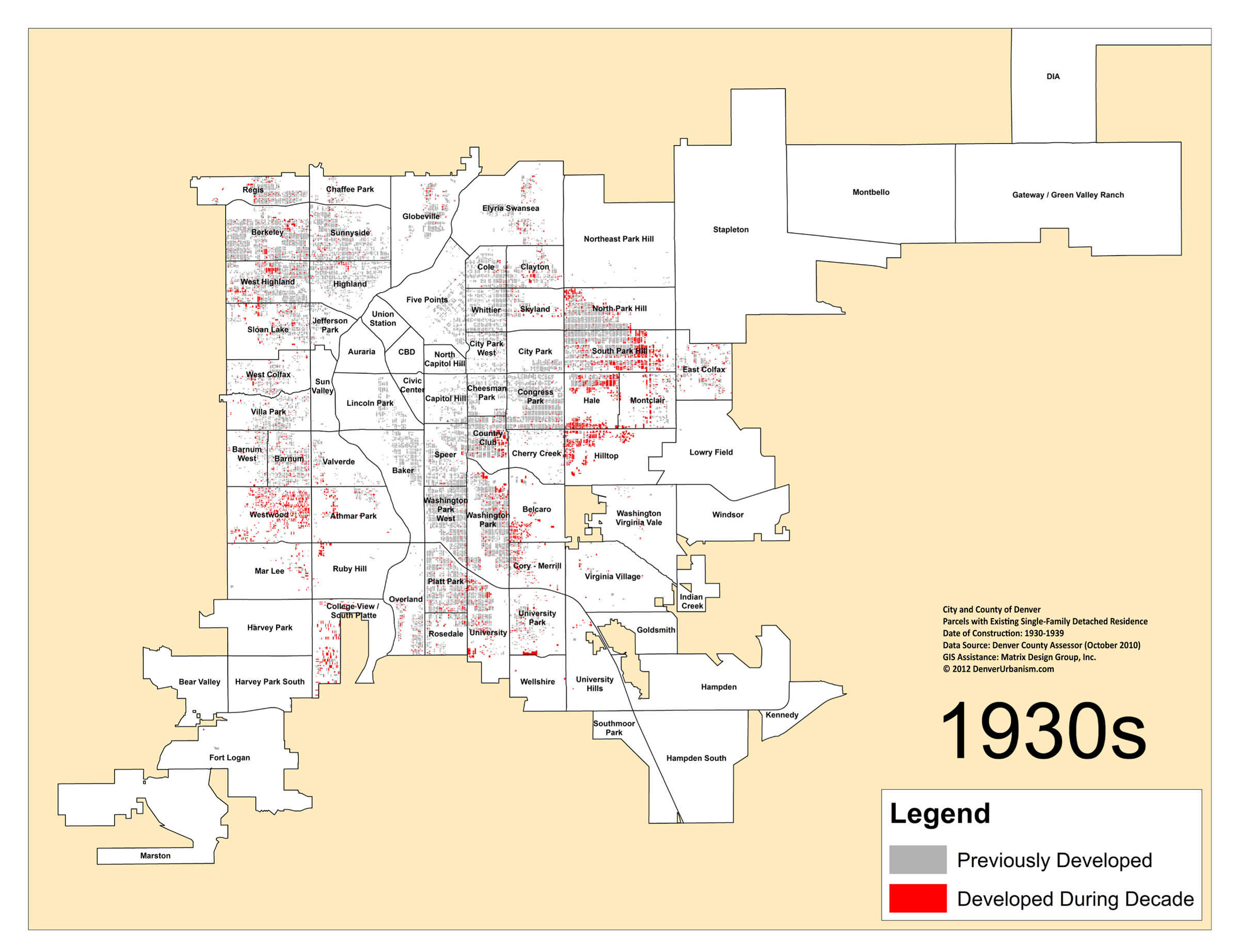
Here’s our Denver Neighborhoods Map showing the city’s single-family residential growth in the 1930s. Parcels with single-family homes built during the 1930s that remain in existence today are colored red. Parcels with homes that were built in a previous decade that remain in existence today are colored gray. Click/expand to see images at full size.
By this point in time, growth in Northwest Denver was clearly tapering off. Some development was still happening in West Highland, but most of the action was farther south in Westwood, where the great neighborhoods of Southwest Denver were starting to take shape. Along with Westwood, the Athmar Park, College View, Mar Lee, and Ruby Hill neighborhoods were getting started.
East of Downtown, Park Hill, Montclair, Hale, and Hilltop remained attractive neighborhoods for development, and farther southeast, the Belcaro, Cory-Merrill, University, and University Park neighborhoods continued to draw new residents.
Interesting development patterns are also evident by the 1930s. Cherry Creek is still quite underdeveloped considering its proximity to Downtown and other developed neighborhoods nearby like Congress Park. Cherry Creek wasn’t a particularly attractive area due to a landfill near where the Cherry Creek shopping district is today. Also interesting was how the Hale neighborhood was filling in from different directions. On its northern edge, growth was spilling across Colfax from popular Park Hill, and on its southern edge, new homes were being built along 6th Avenue Parkway. The map above also shows how another City Beautiful era-inspired street, Monaco Street Parkway, was clearly influencing development patterns in Montclair.
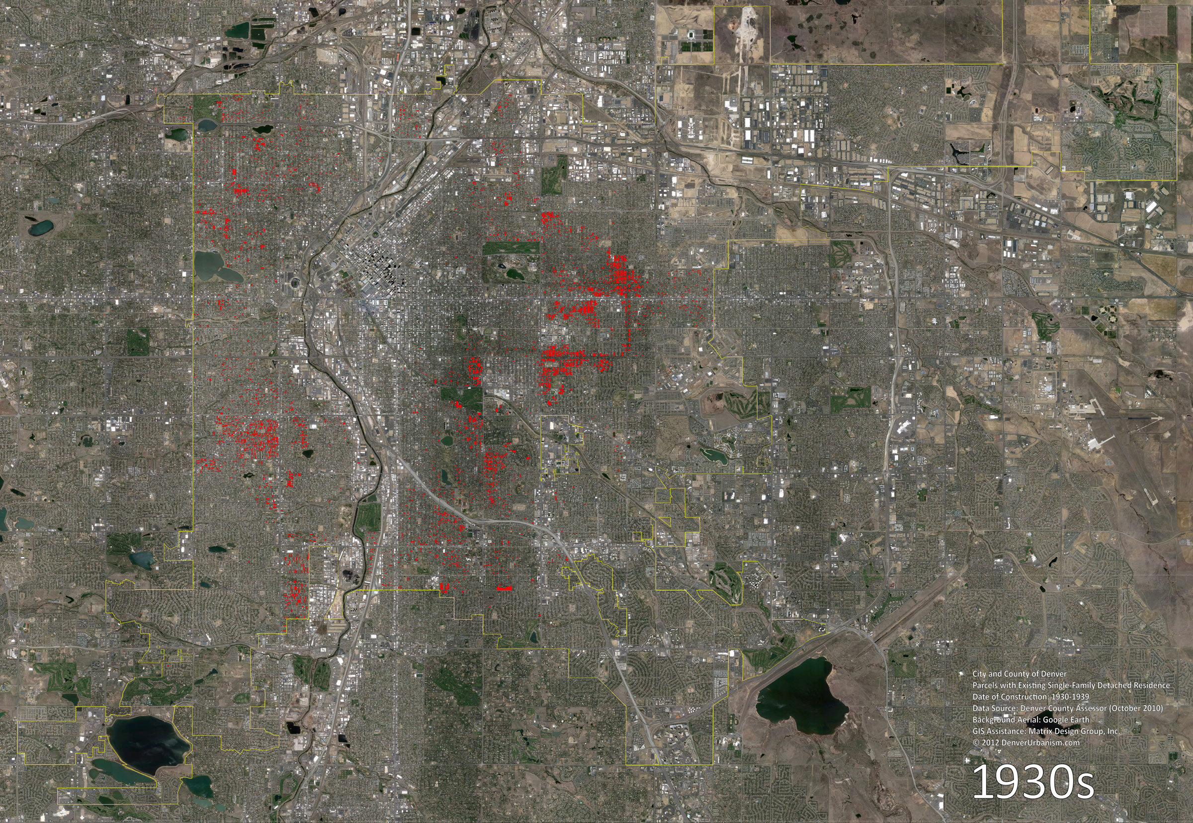
Here are the 1930s parcels colored in red over a current Google Earth aerial:
You know what’s next: Mark’s architecture photos and descriptions!
By the 1930s, small English Revival cottages had replaced the Bungalow as the most popular low- to mid-priced home in Denver. It’s interesting to note that with the economy in the depths of the Great Depression, some of Denver’s most noteworthy landmark residences were constructed during this decade, as materials were inexpensive and skilled laborers commanded only 50 cents an hour.
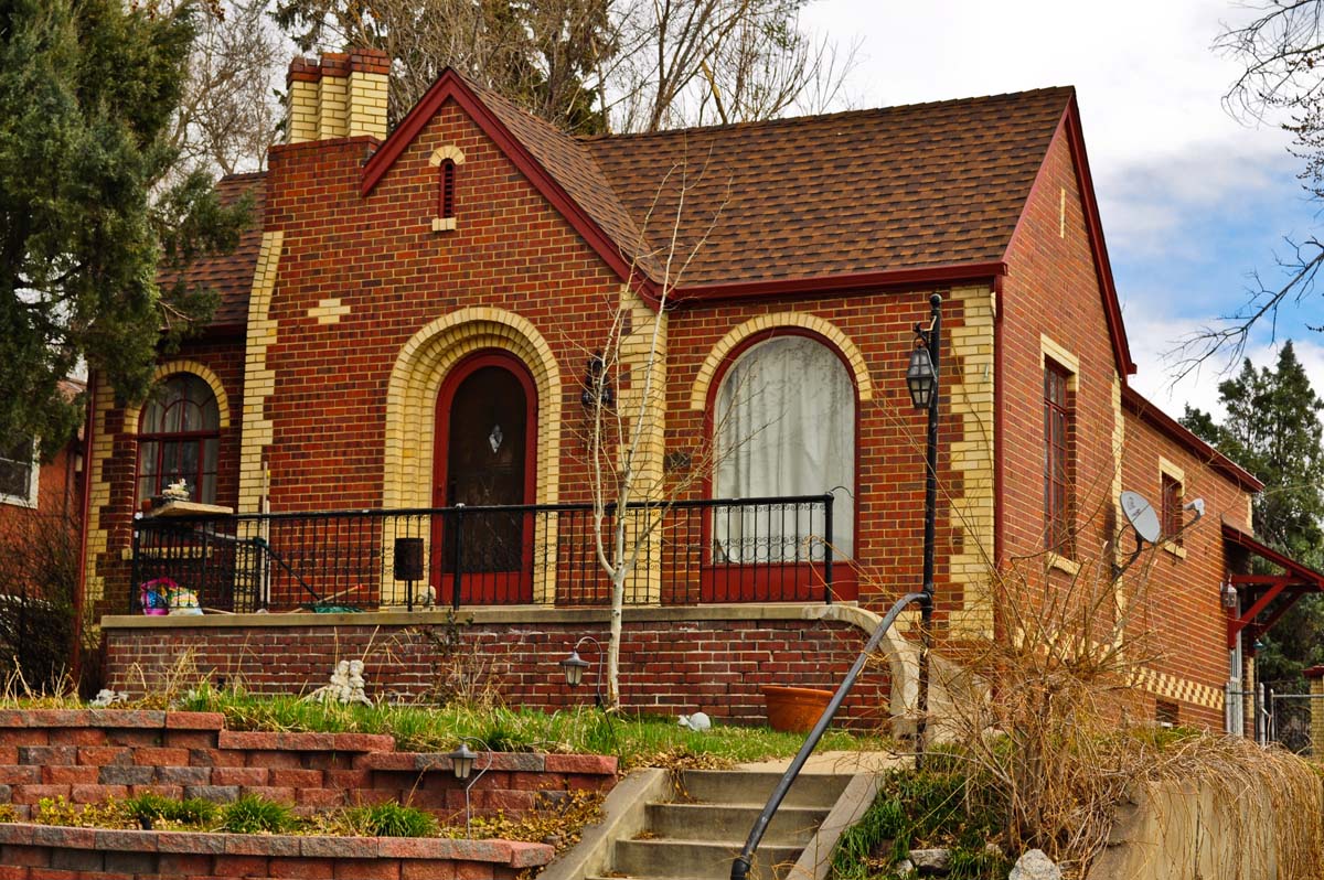
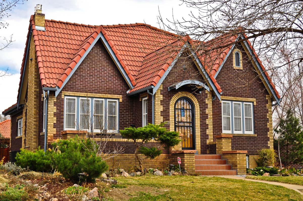
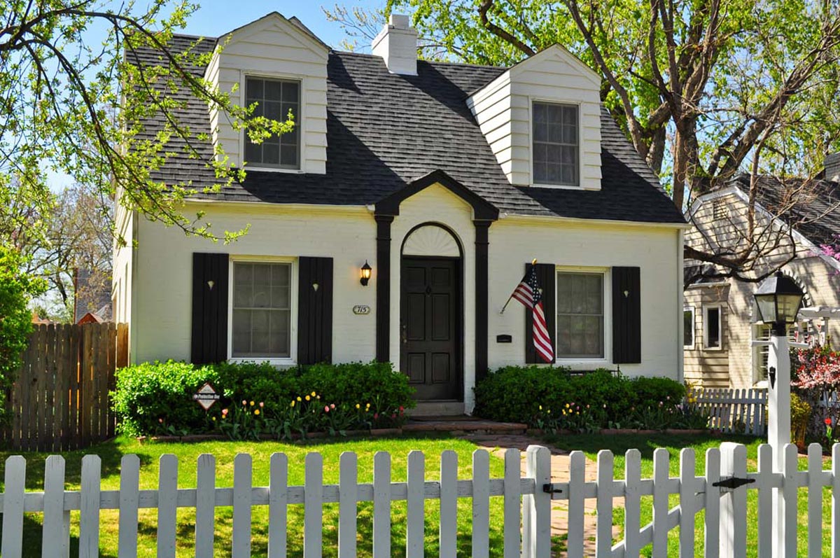
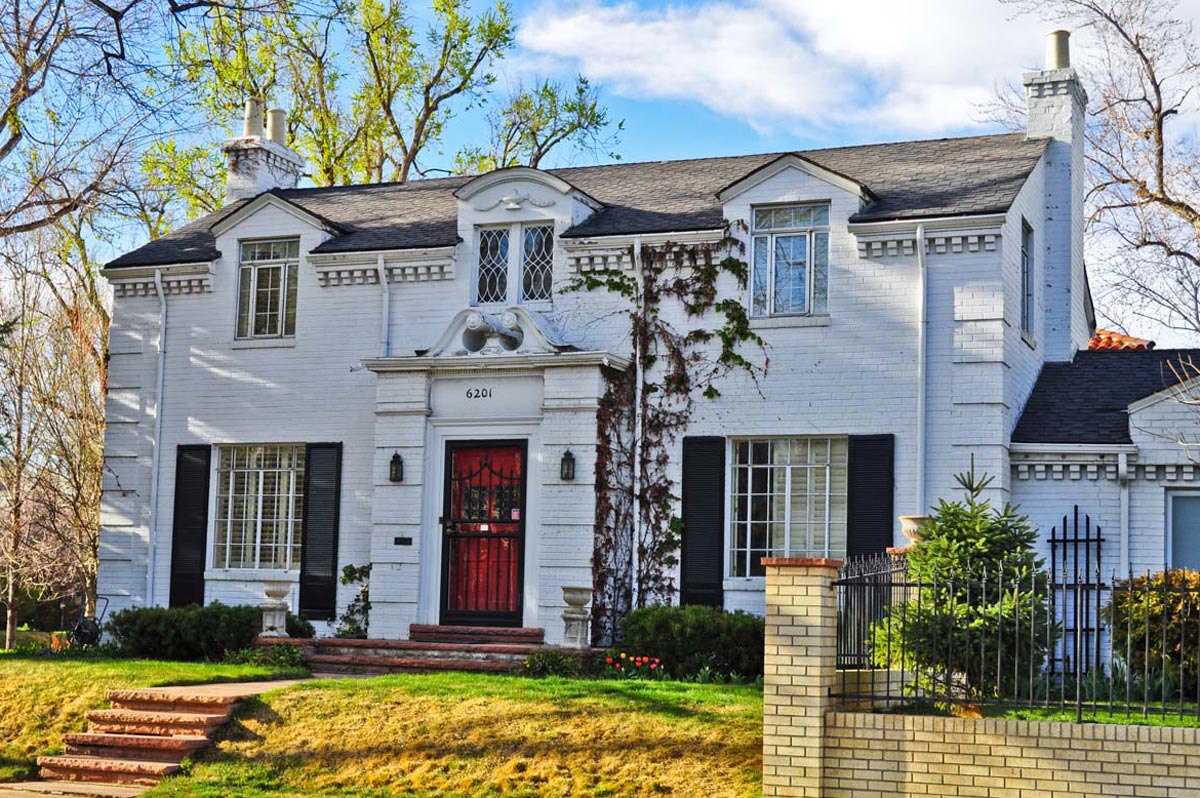
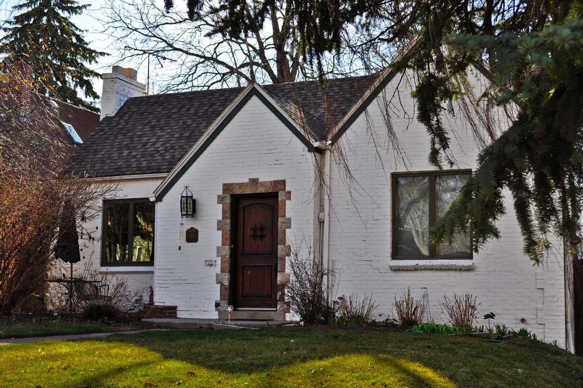
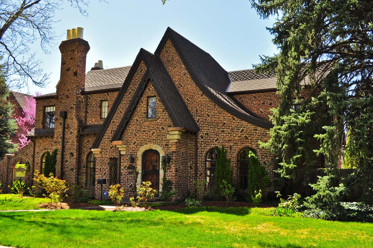
1. Examples of the many “English Cottage” style homes from the decade. These homes were single-story with steep side-gabled roofs and gabled entry pavilions, arched entryways, and they often had an uncovered front porch. Top left (Berkeley), top right (Washington Park), bottom left (Washington Park), bottom right (Country Club):
2. Colonial Revival. Here are two homes of this style, starting on the left with a moderately priced “low style” example (Hale), and on the right, a “high style” home (South Park Hill):
3. French Eclectic. Two French-inspired homes from the decade, both from Hilltop:
4. English Revival. A similar series of Tudor homes from the decade. West Highland on the left, South Park Hill on the right:
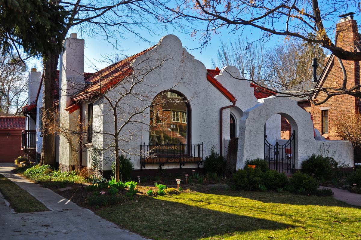
5. Mission Revival. This style features distinctive Mission-style parapets, a low-pitched tile roof, stucco façade, but with a Spanish arcade style wing wall entry (Hilltop):
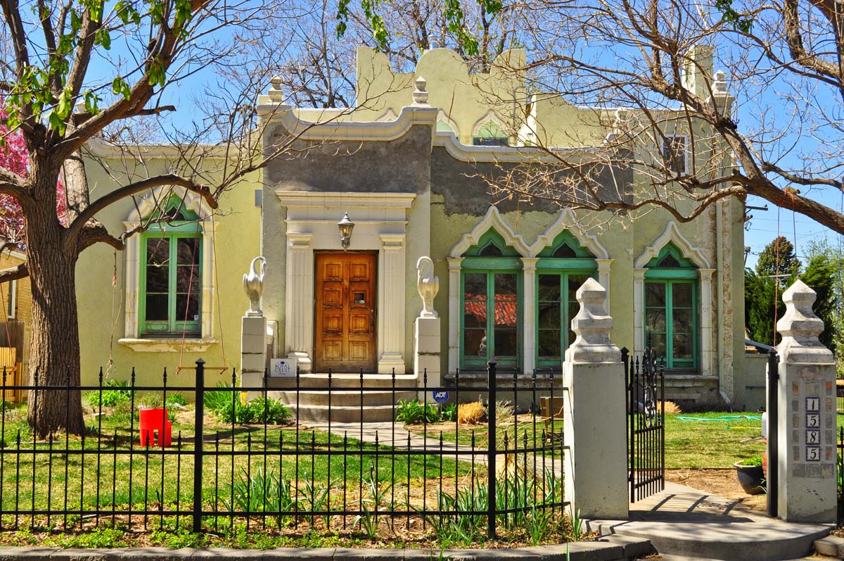
6. Spanish Colonial Revival. A flat-roof style with parapet, a stucco wall surface, and Moorish inspired windows with terra-cotta surrounds. The home also has an elaborate door surround with pilasters (South Park Hill):
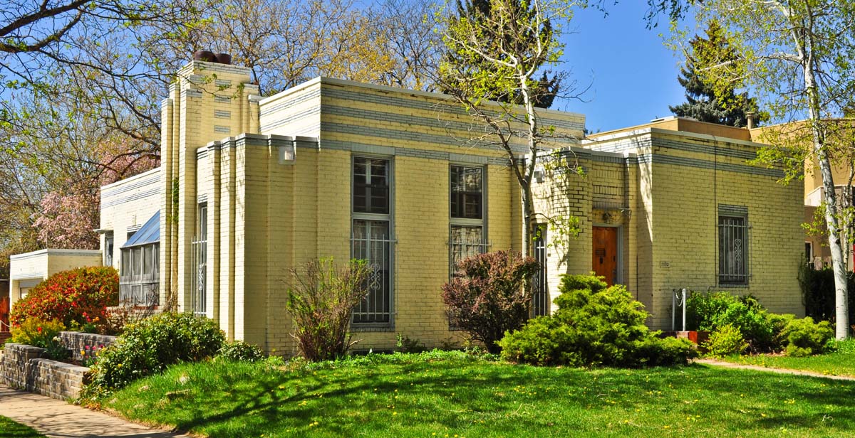
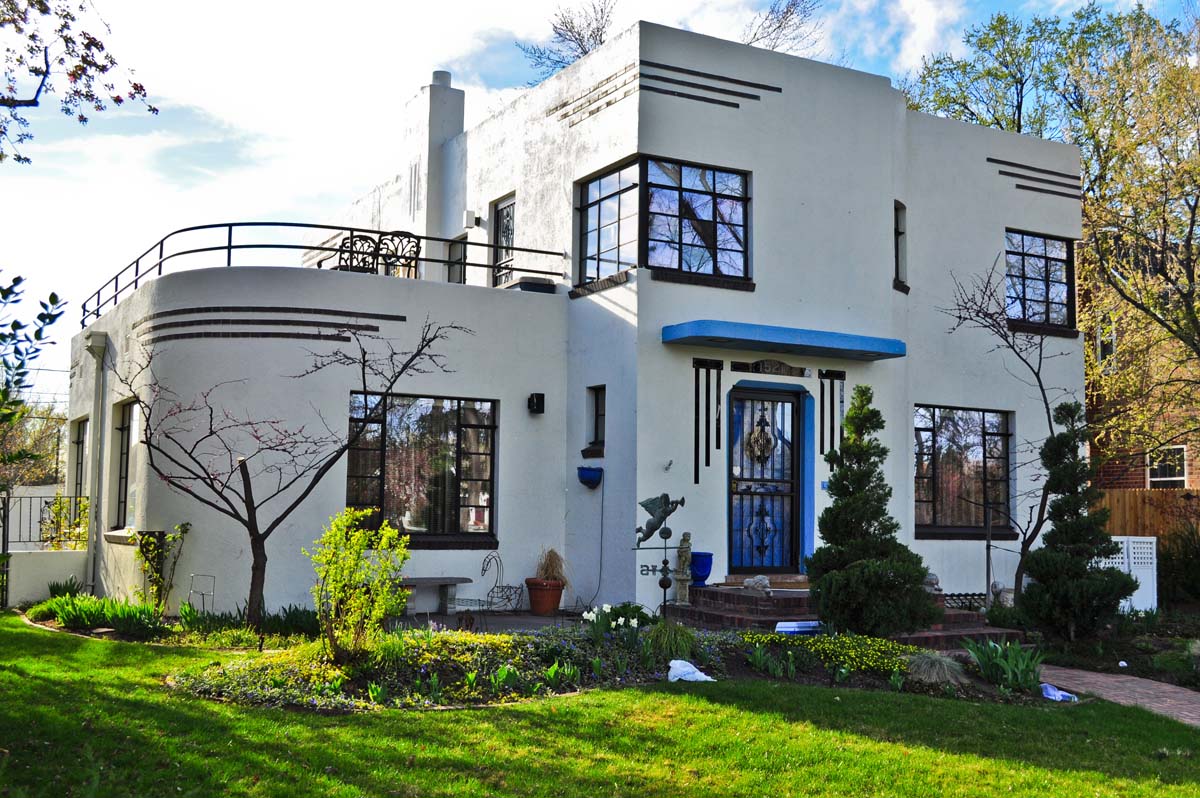
7. Eclectic. While Denver lacks homes of pure Art Deco in both form and decorative elements, this home features Art Deco influences. The style emphasizes verticality with stylized and geometric motifs (zigzags, chevrons, reeding, fluting etc.) as decorative elements on the façade (South Park Hill):
8. Spanish Eclectic. Cross-gabled with a round center tower and tile roof, this home has a low stucco porch wall which incorporates the arched openings and wrought iron gates typical of the Spanish Colonial Revival style (South Park Hill):
9. International. Here are a few examples of the International style from the 1930s. A flat roof without ledge at the roof line, windows that are set flush with the outer walls, and smooth continuous unornamented wall surfaces are typical. Common elaborations include cylindrical forms, multiple roof levels and ribbon windows. Top left is from Hilltop; the other three are from Belcaro.
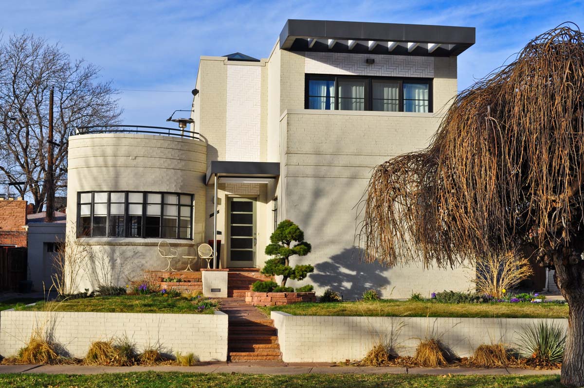
10. Art Moderne/Streamline Moderne. Two examples from this style (although the second is often identified as International depending upon the source). The style gives a horizontal emphasis through the use of horizontal grooves or lines in walls and horizontal balustrade elements. Curved corners, windows that turn a corner and glass-block windows or wall sections are typical. Streamlined industrial design for ships, airplanes, and automobiles after 1930 influenced the style as the smooth, curved , aerodynamic forms were used as source materials. The home on the left is from South Park Hill; on the right, Belcaro.
Up next… the 1940s!











Thank you for doing this blog series, it has been truly amazing to learn more about Denver’s architectural past.
Another fantastic post. Can’t wait for the 40’s. Thank you Ken.
I’m looking forward to the 80s myself.
The last six homes pictured look like they were transplanted out of Disneyland. I wonder how energy efficient they are compared to “traditional” housing?
Based off of this scanned image of the late 30s transit network from the Denver Library, I was able to draw out the routes in Google Maps. The end result is here.
What I find interesting is that most of the neighborhoods that had trolley service back 80 years ago either have a light rail line or one is in planning. While the light rail routes of today might serve different alignments, you can still take a train to Englewood, DU, DUS, Five Points, etc. Everything has changed, yet everything has somewhat stayed the same.
Ken, if you get the chance, could you overlay your development map over a Denver Tramway map? I have a few ideas in mind for a combined map.
Wow. It is a shame that they were all ripped out, otherwise I would have a tram that went directly in front of my apartment!
For the record, they weren’t all ripped out; many were just paved over. When they ripped out the pavement to add some medians on West Colfax last year, the tracks were still there. They found the tracks under North Tennyson street when they recently reconstructed that street as well.
Ken,
Are these photos converted to HDR? They look great!
My favourite decade by far!
Westwood was a separate city at that point in time, right? I could be corrected, but Westwood became part of Denver in the expansion of the county in the 50s.
Neil, I’m not sure if Westwood was a separate city or not. But either way, the area could have developed prior to its annexation into the city. As a future project, I’m planning on an annexation history of the city.
I’ll ask Shawn Snow, who’s quite familiar with annexation issues, to weigh in on this comment.
Westwood had visions of grandeur in the 1940s and did in fact vote for incorporation as a separate town. However, there was so much fighting over the legality of the issue that it was never settled while the area was still part of Arapahoe County. Many residents at the time also wanted to be annexed to Denver. These competing factions vied for the upper hand but by 1947, the whole community was finally annexed by Denver after Arapahoe County lost its court battle to deny Denver in its expansion efforts. In 1943, an adjacent area–then known as Mountain View (Federal, Alameda, Kentucky, Zuni)–had been some of the first land outside of the 1902 boundaries to be annexed by Denver. Thus began a 30 year battle with Arapahoe County as Denver began its march southward seeking new lands for suburban expansion. Westwood and Mountain View were rural enclaves of Arapahoe County. Westwood’s population in the 1940s was fairly significant, around 7-8000 people. Most of the homes built in the area were constructed by the families themselves. Arapahoe County’s lax building codes and somewhat non-existent code enforcement allowed families of simpler means the freedom to do what they wanted to do in terms of what their home (shack, hovel, etc.) would look like. Part of Denver’s quest in bringing Westwood into the city was to allow it to clean up the area and standardize building practices. In addition, residents wanted access to better city services including being hooked up to city water, sanitary sewer, the Denver school district and modern phone and power systems. The Rural Electric Association was vilified in the area prior to annexation for example due to its intermittent service. Lastly, the open farmlands of the area began to fill in with homes especially after 1920 or so but the earliest residents from 1900 did have a school. The Garden Home School opened around 1904 and served the community for many years. It was renamed Westwood School in the early 1940s. It stood at 3615 W. Kentucky Avenue. Denver Public Schools demolished the structure circa 1993 and rebuilt it as Richard Castro School (facing Lowell Blvd.) but the long legacy of education in Westwood is still apparent.
And that, my friends, is all my head can remember at this point!
Wow, thanks for the detailed response!
@Ken, I once saw an animated GIF of Denver’s city boundaries. I can’t remember where or when, and a quick Googling doesn’t find it, but there’s one out there somewhere.
Under Art Deco there should be a photograph of the “Shangri-La” house in Hilltop. It is one of the best Art Deco houses in the country.
Will there be a time-lapse map using the same grey and red dot scheme showing all the decades when the series is done? I’d love to see something like that, it would help me to visualize the changes over time.
Thanks for all of this!
Maybe. 🙂