As you know from Ryan’s recent post, light rail service along RTD’s Central Platte Valley line has been suspended for three weeks (from July 23 to August 14, 2011) for two major reasons: 1.) to tie the existing tracks into the new light rail station at Denver Union Station next to the Millennium Bridge (which Rick is expertly covering at DenverInfill) and 2.) to tie RTD’s under-construction West line’s tracks into the existing CPV line. It is the West light rail integration and the resulting infrastructure reconfiguration that I’ll be focusing on here today.
The West light rail line, scheduled to open in 2013, will terminate at Union Station. To provide West line service to the three stations in the CPV south of Union Station (Auraria West, Mile High Stadium, and Pepsi Center/Elitch’s) requires merging the West line into the existing CPV line after the CPV line has split off from the Central line into Downtown but before the Auraria West station. With the original CPV track alignment and Auraria West station location, that became a very difficult geometry problem.
Here’s a GoogleEarth aerial (from May 2011) showing this area, along with annotations by me. The original Auraria West station is aligned east-west just south of the Auraria Administration Building. By moving the station about 500 feet to the west and rotating it into a north-south alignment, the geometry problem has been solved. In the aerial below, you can see the new station platforms and, to the south, the West line’s curved flyover above the main line freight tracks and the West line’s path northward into the new station (click to embiggen):
Additionally, Union Pacific’s “Burnham Yard Lead” tracks used to branch off from the main line freight tracks next to the Campus Village Apartments, cross 5th Street just south of the existing Auraria West station, and then cross Curtis Street just west of the existing light rail tracks before heading south to Union Pacific’s Burnham Yard near the 10th & Osage Station. To accommodate the new light rail alignment and to remove several railroad crossings, the Burnham Yard Lead tracks were relocated, branching off the main line farther south and running east-west through undeveloped land before turning south around 13th Avenue. Both the “scar” left from the old alignment as well as the new alignment are visible in the aerial.
Finally, as part of the reconfiguration of the whole area, the City had to realign Curtis Street and 5th Street, which had not yet started construction when this aerial was taken, but is now underway. Needless to say, this project required intense cooperation between RTD, the City, the state-owned Auraria Higher Education Center, Union Pacific Railroad, and various utility companies with easements and facilities in the area. The fact that this all managed to get worked out is a good example of intergovernmental cooperation.
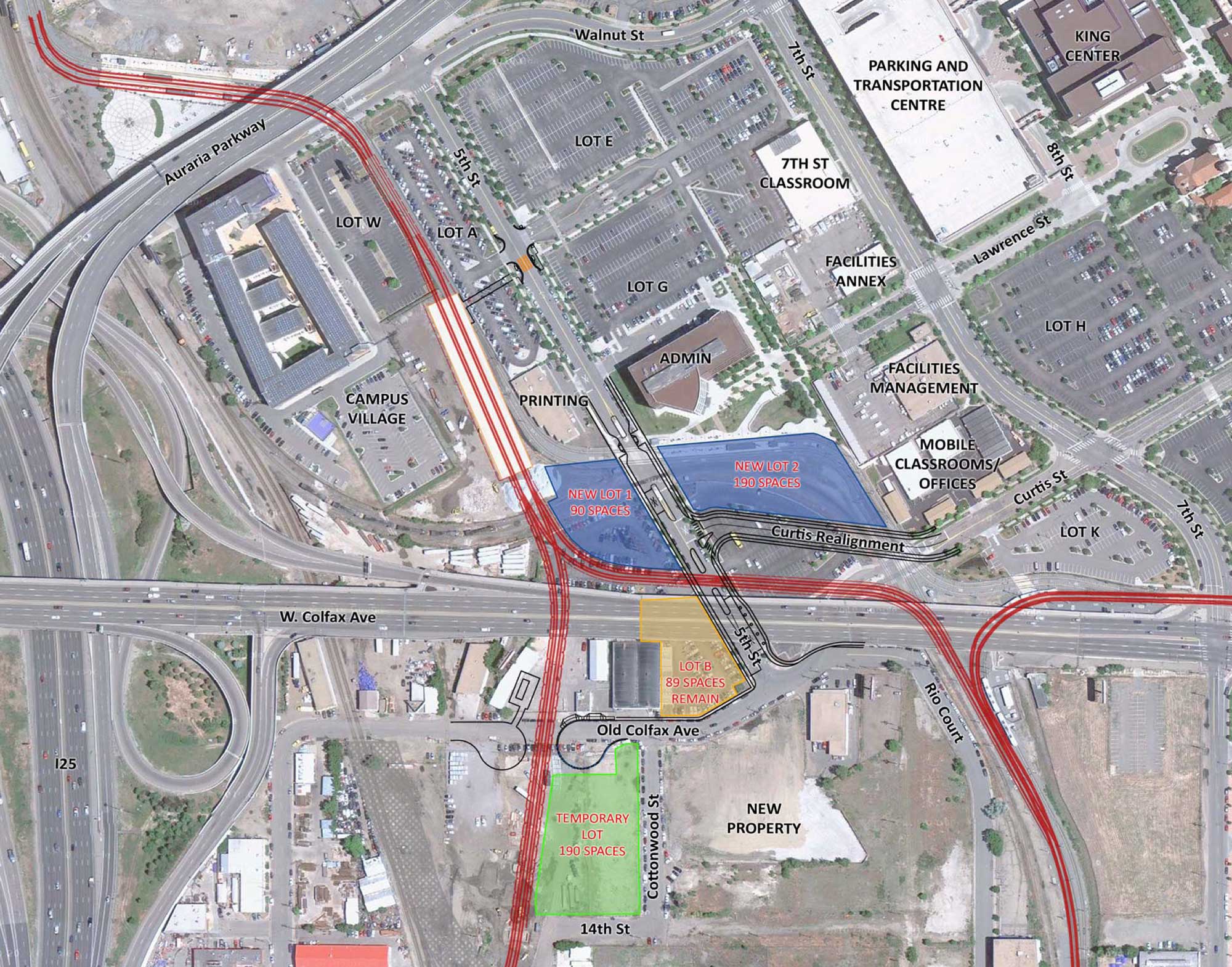
Here’s an exhibit, prepared by RTD for a presentation to AHEC in December 2010, that does a good job of showing the “before and after” planned for the area:
To wrap things up, here are some photos I took this weekend.
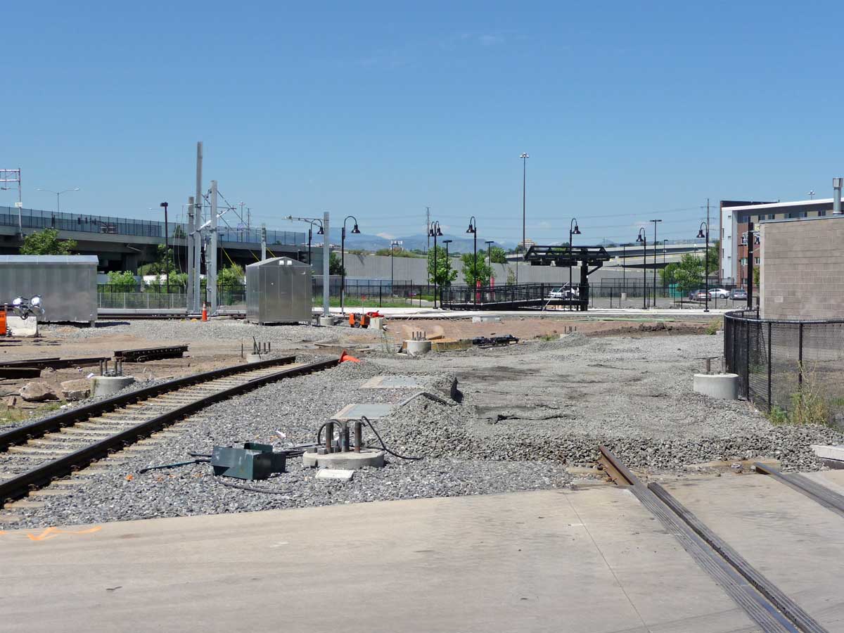
Left: New Auraria West Station looking south
Right: New station looking north
Left: Standing in the middle of 5th Street looking east at the original Auraria West Station
Right: From the same location looking west towards the new station
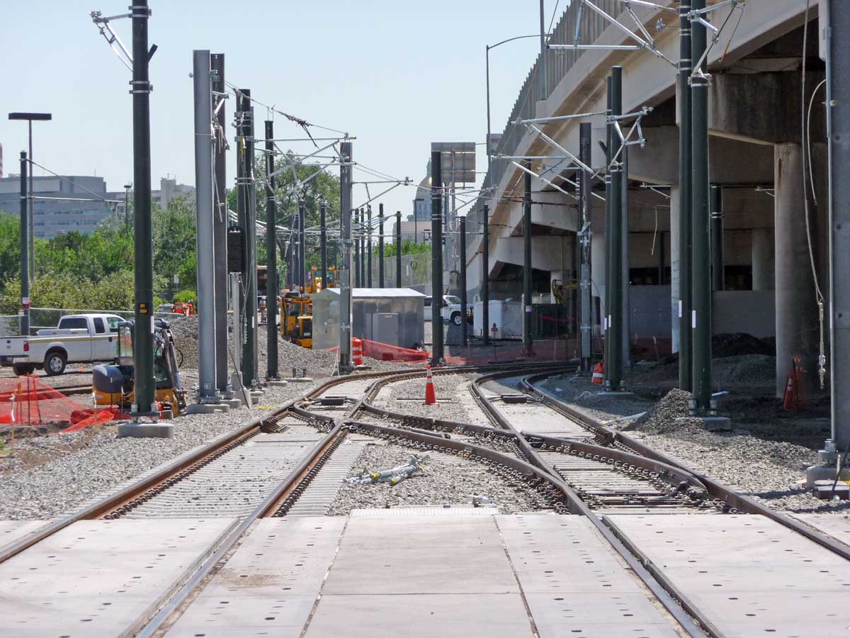
Left: From the new light rail crossing of 5th Street, looking east at the new tracks and their curve south under Colfax
Right: From the same location looking west towards the junction with the new West line
Left: Looking south along the original light rail tracks’ alignment and their crossing of Curtis Street, with workers farther south tying in the new tracks just north of the merge with the Central line
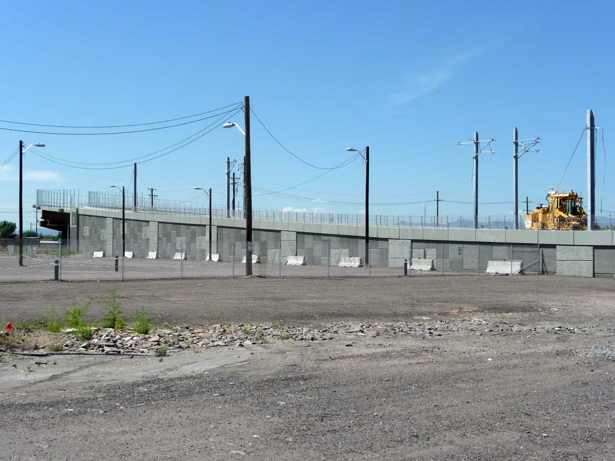
Right: The new West line flyover curve above the freight tracks taken from near Cottonwood Street
Left: Looking east from 5th Street, the old Burnham Yard Lead crossing
Right: Looking east from 5th Street at the newly aligned Curtis Street under construction
The new Auraria West Station will open August 15, the same day as when the new light rail station at Union Station opens.
By the way, in 2009 the City completed the Auraria West Station Area Plan which takes a comprehensive view at the larger area around the station regarding roadway, bike, and pedestrian improvements, land use changes, economic development, and other issues. You can read the full report by downloading it from DenverGov.org here.


Are they really leaving out complementary connections between lines? By that I mean, The intersections look like prongs rather than triangles, allowing vehicles to travel directly from one line to another. I wouldn’t figure it would be used much but it seems easier than going up one line and throwing the train into reverse to get to the other line. For example, to get from the west line (in the southwest of the map) to the central line (in the east) you’d have to come up to the Auraria West station, reverse the train down the southern line to the Osage & 10th station, and then come back up the southern line to get to the central line.
Also, are there any plans to make the Invesco light rail station more convenient to get to Invesco? It’s rather round-about and unpleasant in it’s current state.
It would be nice if as part of the rebuilding of I-25 over the Platte they could make a more direct connection between the Mile High Stadium station and the stadium itself, but I’ve not heard of any such plans at this point.
I had the same question about the complementary connections… the existing rail intersection currently has such a connection, but according to this diagram that connection will actually be removed. Under this new arrangement, trains from the South and Southeast corridors can go to either Union Station or towards the California/Stout lines, but trains from the West corridor can ONLY go to Union Station. This seems very short-sighted especially when you consider the HUGE inconvenience of shutting down access to Auraria/Union Station in order to make such improvements (something that may only be justifiable when making such major changes as they are making now). I really hope the diagram shown above is simply incomplete or incorrect, because I think it is a big mistake the way it is shown.
To the connection situation I believe there is little of any usage of the downtown to Union Station link so they left that out. Though it is puzzling to leave out the West line to downtown track triangles required, I know they want to drive the traffic to Union Station to catch other modes (mall shuttle, downtown circulator bus) to downtown locations.
I agree it doesn’t leave options open! I believe they will correct this when tracks are approved down the middle of east Colfax to Fitzsimmons/I-25 sometime in the 2020s????
As someone who writes the D/F lines into downtown daily, I’ve been watching this and had the same complementary connections question. The connections from the central line (toward 18th/California) to the CPV line (toward Union Stn) have been removed, and the placement of foundations for new light poles makes it seem unlikely they’re being replaced with a tie-in to the revised CPV line, which seems awfully shortsighted.
Thanks, Ken, for the update. The one piece I didn’t know was where the West line was tying in, and now this whole project makes a lot more sense.
And, on further consideration, I’m kind of surprised that the West Line will only go to Union Station, rather that including some lines going toward the theater district and other stops on the Central line. Yeah, people can hop the 16th St shuttle and hoof it from there, but it seems less than ideal.
Also has anyone considered how ridiculously close the Auraria West station and the Mile High Station are? I mean its like the train will take off from one station and 15 seconds later stop at the other. In my opinion they should have just eliminated the Auraria West station altogether. The students would have to walk a block further to get to the station, but it would have eliminated an extra stop and the cost of building a new station that is totally redundant.
Also I very much agree this is a poor connection for those of us on the west. Not only do we only have the option of going to Union Station, but we do not have the option of catching any trains from downtown headed south. It seems to me that the better solution would have been to dead end the west corridor at the 10th and Osage station which would have allowed passengers to easily catch the next train in whatever dirrection they wanted to go (i.e. Downtown, Union Station, SE or SW). The line then could have been extended in the future to destinations like the Santa Fe arts district and the Golden Triangle. But alas as some have joked RTD stands for Return To Downtown so any option that did not go directly to Downtown was probably out of the question.
You’ve got two options to catch a train heading south: the C and the E lines and you can transfer at four different stations (Auraria West, Invesco, Pepsi Center, and Union Station).
I believe that one of the reasons that the West line doesn’t feed into the DT loop is because the loop is at capacity. Barring an additional line running into DT from the south, such as a Broadway line, you can’t squeeze anymore trains onto the loop.
Sorry Paul, i wasn’t quite clear on my post. What I meant to say is that you do not have the option of catching southbound trains from the central downtown; the DF&H lines will all be mostly inaccessible to the west corridor (without a dash over to the other Auraria station). If the line dead ended at the 10th and Osage station, one could catch any of the 5 lines heading south and therefore improve travel times from the west line to points south.