Lots of American cities are building streetcars right now. But how are streetcars different from light rail? The truth is they’re very similar, and many systems are hybrids of the two. To tell the difference, one has to simultaneously look at the tracks, train vehicles, and stations.
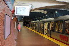
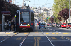
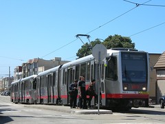
San Francisco’s Muni Metro runs both in a dedicated subway and on the street in mixed traffic.
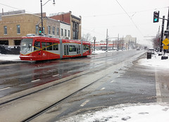
Is it a streetcar or light rail system? Photos by Matt Johnson and SFbay on Flickr.
It’s hard to tell the difference because streetcars and light rail are really the same technology, but with different operating characteristics that serve different types of trips.
The difference, in a nutshell
Theoretically streetcars are simply light rail that’s designed to serve trips over a shorter distance, through more tightly packed urban environments. They’re for travel within central cities, as opposed to travel from the suburbs into downtown. But what does that mean in practice?
There are several features of tracks, vehicles, and stations that both streetcars and light rail sometimes have, but which are generally more common on light rail. Thus, although there’s no single separating test that can tell the two apart with 100% accuracy, it’s usually possible to tell the difference by looking at several factors simultaneously.
Let’s look at each of those factors, one by one.
Lanes and tracks
It’s a common misconception that streetcars always run in mixed traffic with cars, while light rail has its own dedicated track space. That’s often true, and it’s such a convenient and easy-to-understand definition that I’ve been guilty of using it myself. But it’s wrong.
Sometimes light rail lines run in mixed-traffic, and there are plenty of streetcars with their own right-of-way. Some streetcars even have subways.
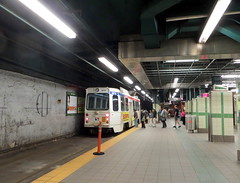
Compare Sacramento’s mixed-traffic light rail with Philadelphia’s streetcar subway, for instance:
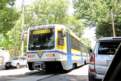
Left: Sacramento light rail in mixed traffic. Photo by Flastic on Wikipedia.
Right: Philadelphia streetcar in a subway. Photo by John Smatlak via Flickr.
Every light rail system has long stretches of dedicated track, but so do some streetcars. And in fact, practically every mixed-traffic streetcar has at least a short section of dedicated track. Toronto’s massive streetcar network has several dedicated transitways, and DC is planning one for its K Street streetcar.
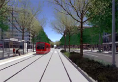
Left: K Street transitway. Image from DC Streetcar.
Right: Toronto’s Saint Clair transitway. Photo by Sean Marshall via Flickr.
There are too many streetcars with dedicated lanes for that to be a reliable indicator on its own. Too many lines that mix dedicated and non-dedicated sections. Certainly it’s an important data point; certainly it’s one factor that can help tell the difference. But it’s not enough.
An even simpler definition might be to call anything with tracks in the street a streetcar, and anything with tracks elsewhere light rail.
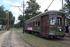
But that’s not reliable either, as Portland and New Orleans illustrate:
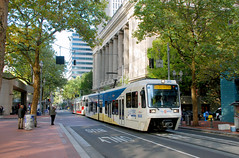
Left: Portland light rail. Photo by BeyondDC.
Right: New Orleans streetcar. Photo by karmacamilleeon via Flickr.
Or take the Fort Collins Municipal Railway. It’s mostly for tourists, but it’s a streetcar, and it runs through grass.
Salt Lake City muddies the water still further. Its “light rail” mostly runs in the street, while its “streetcar” runs in an old freight train right of way, almost completely off-street.
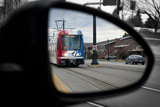
Left: Salt Lake City light rail. Photo by VXLA on Flickr.
Right: Salt Lake City streetcar. Photo by Paul Kimo McGregor on Flickr.
Vehicles and trains
If tracks on their own aren’t enough to tell the difference, what about vehicles?
It’s tempting to think of streetcars as “lighter” light rail, which implies smaller vehicles. Sometimes that’s true; a single DC streetcar is 66 feet long, compared to a single Denver light rail car, which is over 80 feet long.
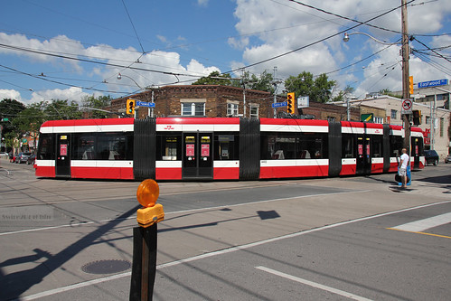
But not all streetcars are short. Toronto’s newest streetcars are 99 feet long.
Toronto streetcar. Photo by Swire on Flickr.
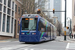
In fact, many light rail and streetcar lines use the exact same vehicles. For example, Tacoma calls its Link line light rail, and uses the same train model as streetcars in Portland, DC, and Seattle, while Atlanta’s streetcar uses the same train model as light rail in San Diego, Norfolk, and Charlotte. And Salt Lake City uses the same train model for both its streetcar and light rail services.
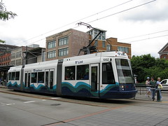
Left: Tacoma light rail. Photo by Marcel Marchon via Flickr.
Right: Portland streetcar. Photo by Matt Johnson on Flickr.
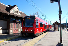
Left: San Diego light rail. Photo by BeyondDC.
Right: Atlanta streetcar. Photo by Matt Johnson via Flickr.
And although streetcars often run as single railcars while light rail often runs with trains made up of multiple railcars, there are exceptions to that too.
San Francisco’s Muni Metro and Boston’s Green Line definitely blur the line between streetcar & light rail, perhaps more than any other systems in North America. Some might hesitate to call them streetcars. But they both run trains in mixed-traffic with cars, and some of those trains have multiple railcars.
Meanwhile, many light rail systems frequently run single-car trains, especially during off-peak hours.
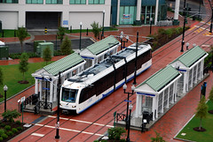
Left: Norfolk light rail with a single car. Photo by BeyondDC.
Right: San Francisco streetcar with two cars. Photo by Stephen Rees via Flickr.
Stations offer some help, but no guarantee
Light rail typically has bigger stations, while streetcars typically have smaller ones. A big station can sometimes be a good clue that you’re likely dealing with light rail.
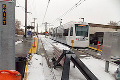
For example, look at Charlotte and Portland:
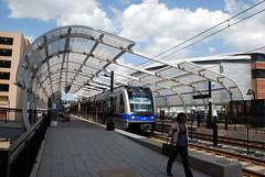
Left: Charlotte light rail. Photo by BeyondDC.
Right: Portland streetcar. Photo by BeyondDC.
But that’s only a general guideline, not a hard rule. Just like tracks and vehicles, there are many exceptions. Light rail often has small stops, and streetcar stations can sometimes get pretty big (especially when they’re in a subway).
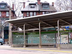
This light rail stop in Norfolk is smaller than this streetcar stop in Philadelphia, for example:
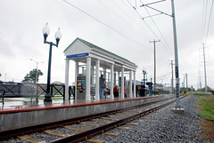
Left: Norfolk light rail. Photo by BeyondDC.
Right: Philadelphia streetcar. Photo by BeyondDC.
Stop spacing and route length
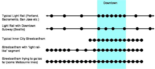
Probably the most reliable way to tell streetcars apart from light rail is to look at where the stations are located. Light rail lines typically have stops further apart from each other, on lines covering a longer distance.
This chart explains the difference:
This is the definition transit expert Jarrett Walker favors, and if you have to pick just one or two factors to consider, stop spacing and route length are the best.
But even this is no sure way to categorize all lines as either streetcars or light rail. It might be easy to tell the difference between something with stops one block apart (theoretically streetcar) versus stops two miles apart (theoretically light rail), but what if the stops are 1/4 mile apart? Or what if the gaps aren’t consistent? There’s no clear place to draw the line.
Furthermore, Walker’s graphic itself illustrates exceptions to the rule. The top line shows a light rail route with stops close together downtown, the third line shows a streetcar with some sections that have far-apart stations, and the fourth line shows a very long streetcar.
Certainly station spacing and route length provide a convenient general rule, but only that. There’s no hard boundary where everything to one side is streetcar, and everything to the other is light rail.
To really know the difference, look at everything
There are seven factors that light rail usually has, but that streetcars only sometimes share: Dedicated lanes, off-street tracks, bigger vehicles, multi-car trains, longer routes, bigger stations, and long distances between stations.
No single one of them provides a foolproof litmus test, because sometimes streetcars have each of them, and sometimes light rail doesn’t. But if you look at all seven together and determine which direction the majority of a line’s characteristics point, over the majority of its route, then you can usually sort most lines into one category or the other.
For example, DC’s H Street line fits neatly into the streetcar category, because it runs in the street almost totally in mixed traffic, with small vehicles on single-car trains, along a short route that has frequent, small stations.
On the other end of the spectrum, Seattle’s Central route is squarely light rail. It has a dedicated right-of-way that’s often off-street, uses large 95 foot-long vehicles that are usually coupled into multi-car trains, along a long route with infrequent stations.
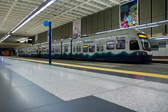
Left: Seattle light rail. Photo by Atomic Taco on Flickr.
Right: DC streetcar. Photo by BeyondDC.
But even then not every system is crystal clear. San Francisco’s Muni Metro, Philadelphia and Boston’s Green Lines, and Pittsburgh’s T, for example, all have some segments that look like classic streetcars, but also some segments that look like classic light rail. These networks defy any characterization, except as hybrids.
And in Denver, RTD is considering re-categorizing the Central light rail line though Five Points as a streetcar.
It’s a feature, not a bug
The fact that it’s hard to tell the difference is precisely why so many cities are building light rail / streetcar lines. The technology is flexible to whatever service characteristics a city might need.
You can use it to build a regional subway like Seattle, or you can use it for a short neighborhood circulator like DC’s H Street, or anything in-between. And perhaps even more importantly, you can use it to mix and match multiple characteristics on the same line, or within the same system.
That’s why many of the most successful light rail / streetcar systems are the hardest ones to categorize as either / or. They match the infrastructure investment to the needs of the corridor, on a case-by-case basis, and thus have some sections that look like light rail, and others that look like streetcar.
That’s not muddied. That’s smart. That’s matching the investment to the need, which is after all more important than a line’s name.








Thanks Dan, for a very smart report! Good to know that RTD sees the Central Line as the city-wide prototype for streetcars — the most important future development for Denver. Nothing transforms the streetscape like rail.
I don’t really think there’s much difference between “streetcars” and “light rail”. “Light rail” was invented as a marketing term during a period when “streetcar” was considered to be an old-fashioned term.
The big difference is between streetcars/light rail on the one hand, “metro”, and “mainline rail”.
A metro is entirely grade-separated with no grade crossings. Even here there’s some overlap, since Chicago’s system has grade crossings. But a metro *cannot* run down a street, whereas light rail / streetcars can.
This makes light rail streetcars more flexible — Boston’s Green Line and Philadelphia’s “Subway-Surface Trolleys” are good examples, going from underground tunnels in downtown to running along streets further out.
Mainline rail has grade crossings, but also have gates and lights. It can run down a street (Amtrak does in Oakland, CA), but it’s extremely discouraged and it has to run very slowly when it does so. It is generally identified by big, heavy locomotives; but the key feature is that mainline rail is designed to accomodate either freight, or high-speed, long-distance intercity travel. Light rail streetcars and metro systems avoid freight and are not designed to accomodate high-speed, long-distance intercity trips.
I wonder what this makes Mall Ride, then? Is it still just a bus, or is it basically a street car with tires rather than tracks? It has the station size and the stop frequency of the street car examples above, and it has a somewhat dedicated right-of-way, depending on whether you count all the pedestrians wandering around.
The MallRide is what’s referred to as a shuttle.
Dan, couple thoughts on the K Street streetcar line to Georgetown, as you live in DC and know the history of rail development there. I worked in DC for 10 years, lived in Northern Virginia, rode the Metro Orange Line from Vienna for 9 years, while the basic Metro build-out continued during the late 80s and most of the 90s.
The Metro subway system was conceived during the Eisenhower Administration, initially funded during Kennedy, and construction started under Johnson, on the Red Line, in and out of Montgomery County, MD. MORE THAN 50 YEARS LATER, the basic 85-mile system was finished, with the Green Line, in an out of Prince George’s County! Half-subway (in the inner city areas), and half above-ground in the burbs. Now it’s being extended into Tyson’s Corner and beyond to Dulles Airport.
It’s the best subway system in the nation, but NYMBYS have fought Metro development every step of the way, tripling the costs and delaying construction for decades. The worst NYMBY logjam was in Georgetown — where the local business fears of being “torn up” for years of subway construction finally killed the proposed route.
Across the Potomac, Alexandria welcomed the Yellow Line, and Old Towne Alexandria has boomed as a result. Georgetown, in contrast, degraded into a lot of T-shirt, tattoo and pawn shops — along with many surviving “higher grade” businesses — but certainly not a development boom. The NYMBY result: stagnation.
Now, with a streetcar line coming from Union Station, Georgetown will finally prosper, as a very hip — and very pricey — part of Northwest Washington. And to be fair, Georgetown is only being “torn up” for a short time, during construction, compared to what the subway construction was like everywhere in DC, while Metro was built. (You may remember Market Street in San Francisco was also torn up for years in the 70s, while Bart was being built.)
And in the long run, a streetcar line will probably be far better for the Georgetown retail/restaurant scene than a subway — with more frequent stops, and much easier access for pedestrians than coming up from underground stations.
So what does all this rail development history have to do with Denver?
1. Streetcars are by far the cheapest rail system to design and build. Subways — any kind of underground construction — are the most expensive and the biggest engineering challenges, as LA is learning, as it resumes its long-delayed “Subway to the Sea” along Wilshire — which will very likely take 20 more years to finish!
Elevated trains, as in Chicago and New York, also cost many times what at-grade streetcar lines cost, and present huge engineering challenges, as well as expensive access problems for riders (stairs, escalators, safety, etc.).
2. Streetcars are by far the easiest — and safest — kind of rail travel for riders, because they’re right at-grade for walkers, along sidewalks, just easy steps from storefronts, cafes and entrances to office buildings and housing. Because the streetcar is part of the streetscape, they are safer for riders, who don’t have to go down into tunnel platforms, or up onto lonely platforms at night.
Streetcars (or light rail, if you prefer) are an integrated PART OF THE STREETSCAPE — and not separated, or more distant, above or below the street.
And again, they can get built a lot faster and cheaper than heavy rail — with a lot less opposition from the NYMBYS!
So bottom line, Denver, let’s get with it, and re-design, re-think the Central Line quickly, with an eye to expanding street rail, from Union Station down Broadway, to link up with light rail at I-25, with a Southeast branch down Speer to Cherry Creek and on down Colorado to meet the light rail there. The success of street rail in these highest-density areas of Denver will have people in North, Southwest and East Denver demanding the same service, along all the city’s big streets.
And, to repeat myself, this is nothing new. A 250-mile system was actually built in Denver, and served the entire city, going back a hundred years, until the car culture came along and tore it up after WW2.
Dan, thank you for putting the spotlight on what Denver needs now, to become the world-class city it can be. Looks like RTD recognizes what’s needed in he city, now that the suburbs are being given an escape from the car, with a real option on commuter trains.
Denverites, it’s time to stand up and demand what people who live in every other big city in America are getting. See you at the next RTD streetcar public hearing…
Would it make sense to run a streetcar down the 16th St Mall instead of the buses? It would definitely look much nicer and the frequencies would be similar. Maybe have stops spread out every 2 blocks instead of at each block? I like Salt Lake City’s new streetcar the best, very sharp design.
*Sigh*
Yes, it would make sense to run streetcars down the 16th St. Mall instead of the buses.
It would make sense to have some reverse at the end of the line at the Capitol as they do now.
But it would make more sense for most of the streetcars to continue in exclusive lanes down East Colfax from the Capitol to *at least* Colorado Boulevard, but preferably Fitzsimmons Parkway.
Good luck getting the Colfax Streetcar, guys. It’s needed yesterday.