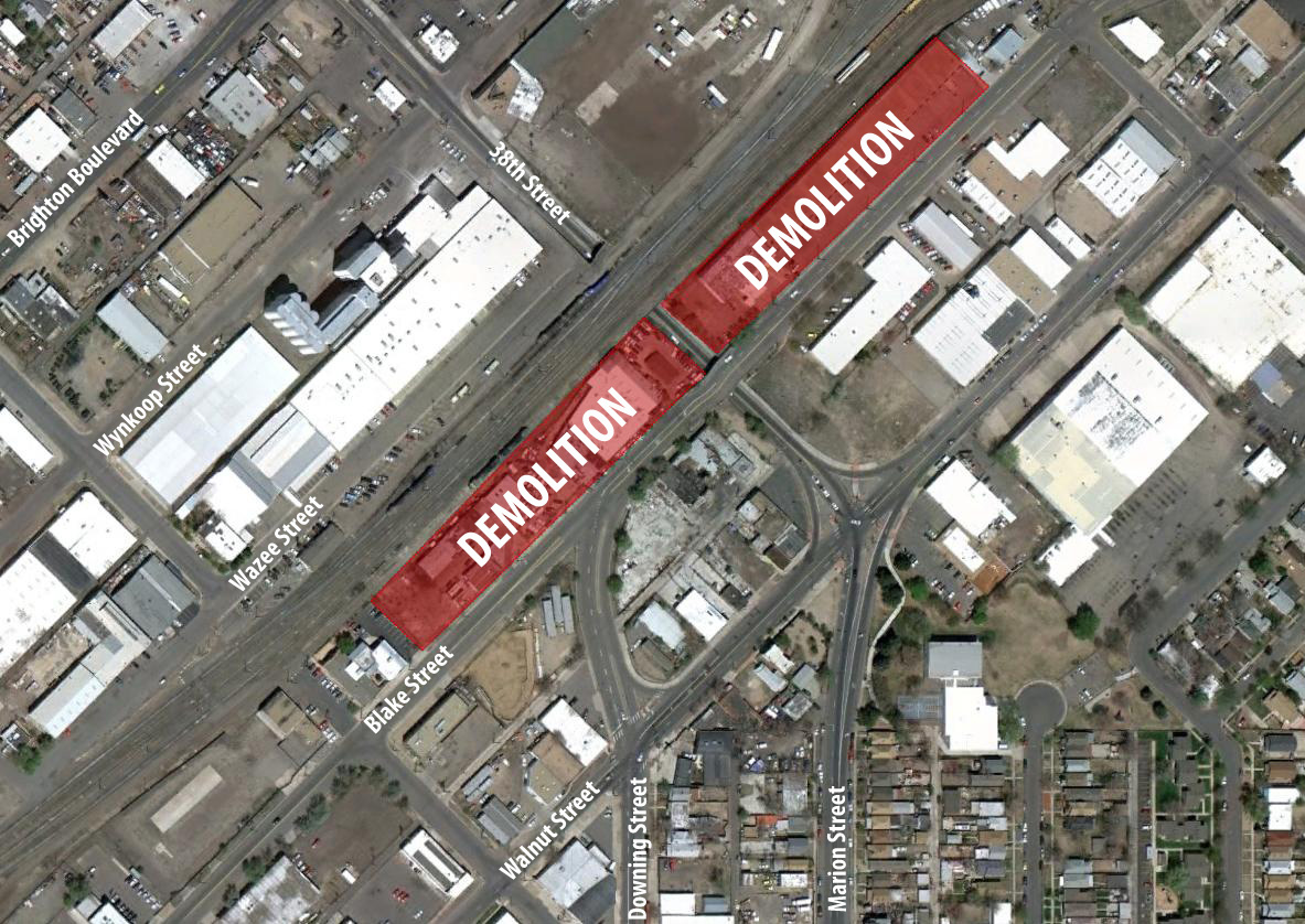
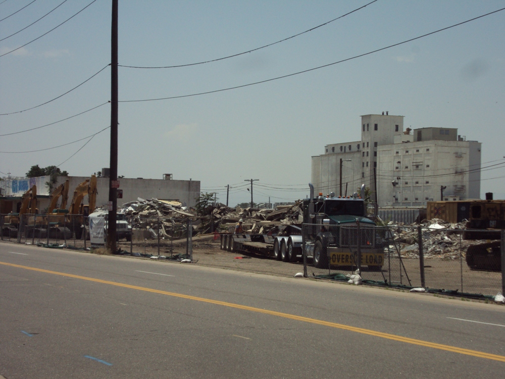
Crews have started (and are nearly finished) with demolition of the existing buildings at the future 38th/Blake Station site. The buildings were mostly empty with the exception of a tofu business, which sold its assets to another company instead of relocating. Take a look at the map below – it gives an idea as to size of the site being demolished to make way for the station.
The demolition going on right now is for the station platform, a plaza, the landing for a pedestrian bridge crossing the Union Pacific tracks, and some (mainly) handicapped parking spaces. The majority of the parking will be located to the north of the platform on the opposite side of 38th Street. Demolition on a former self-storage facility at that site will kick-off soon (and will be covered in a future blog post).
The pictures below show the area that will serve as the landing area for the pedestrian bridge as well as contain some handicapped parking spaces. This demolition helps remove several blighted and unsightly buildings from the neighborhood.
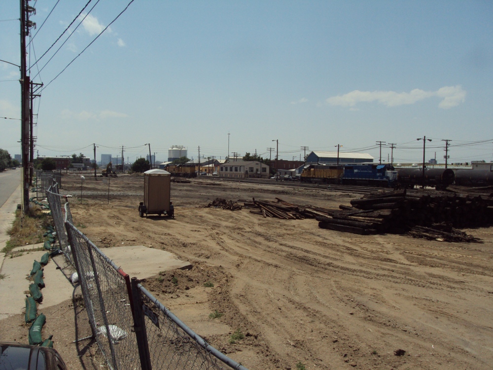
The station platform and a large plaza area will be located to the south and west of 38th Street north of Blake Street. From the picture below, you can see how large this plaza and station area is. There will be an additional set of tracks constructed for the East Rail Line next to the current Union Pacific tracks. This area will eventually also serve as the transfer point between the East Rail Line and the Central Corridor once light rail (or streetcar) is extended north from 30th & Downing to 38th & Blake.
Stay tuned – this project is quickly coming to life and there’ll be lots of updates to come! Bridge construction is complete at Broadway, underway at Quebec Street, Sand Creek, and Peña Boulevard, and will soon be underway at I-70 while grading and other relocation work is underway to move Union Pacific tracks slightly north to allow the East Rail Line to squeeze through.


Thanks for the write up Ryan. Do you know if the East line stations are supposed to have more coverage from the elements than the LRT stations? Should the other stations be about this large? Are they large because of the length of the train cars?
Lastly, it seems like RTD should have no trouble finishing this project by 2016. Does it seem to you that it will finish well ahead of schedule?
The commuter rail stations and their platforms will be larger than light rail stations, mainly due to the length of the train cars. They’ll all be about the same size along the corridor.
The 2016 timeline is the goal – there’s a lot of changes going on along Pena Boulevard in terms of the design that can add some significant time to the schedule, but I hear RTD and their contractor are working through that. January 2016 is the date I hear most often. If/when it may change, I’ll keep everyone posted.
Great photos and explanation. I’m excited about all the upcoming work that we’ll get to see and read about, thanks to you, Ryan.
R.I.P. Denver Tofu
I was in Denver in May and didn’t even notice the East Line bridge over Broadway. Are there any pictures of it anywhere?
It’s pretty easy to miss. I’ll snag some pictures of it this weekend.
What’s the word on the extension from 30th & Downing to 38th & Blake? We hear a lot about the other Fastracks components’ financial difficulties but not so many about this one. I assume that it isn’t funded, but how much funding is it short by, and where is it on the priorities list?
You’re right – it isn’t funded, unfortunately. It’s a complicated story stemming from the City of Denver and RTD. RTD and CCD are doing some more engineering along Downing and evaluating the corridor. From what I hear, they’re also looking at the possibility of introducing streetcar along Welton/Downing to replace LRT as well. I haven’t heard a timetable for completion along that extension and priorities-wise, it’s fairly low down the chain. I also haven’t heard a cost estimate, but given the cost of the SE extension ($200M-ish), I’d say it’d be at least $100M. Don’t hold me to it, though.
I live very close to the extension, so I’ll definitely keep people in the loop when I hear of anything.
Can streetcars be integrated with LRT? Would a streetcar have to stop before the downtown loop, and then passengers would have to change to a D or H train, or could they run on the same tracks as LRT and complete the loop to 14th Street?
Also, I saw a proposed map of the central corridor after its expansion and it looked like the last stop would be the 16th street mall, before the train looped back around. Is there no way to provide a stop closer to 14th and the Performing Arts Center? In bad weather, it’s nice to be able to ride the D Line right to 14th Street when attending a show at the performing arts center.
Yes, they can. It would, as my understanding, do the downtown loop and go back out Welton. Passengers would have to then transfer to a southbound train.
Short of the Theatre District/Convention Center Station moving (which it won’t), I don’t see a station moving closer to 14th, unfortunately.