As urban cycling becomes more common, new terms are entering the lexicon that people may not be completely familiar with. This post will provide a guide to the most common types of urban bikeways.
There are seven basic types of bicycle travelways. In increasing order of separation quality, they are:
Mixed traffic
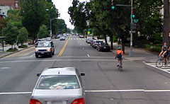 | Mixed traffic bikeways are simply regular streets on which bikes are permitted to mix with cars. Almost every street in existence qualifies, except those with dedicated bike facilities, or the few where bikes are specifically outlawed. Many jurisdictions designate some streets as “suggested bike routes,” which are mixed traffic streets that are deemed to be inherently bike-friendly, but where no (or limited) special treatments have been applied. Boulder’s bike map provides a good example: normal uncolored streets are normal roads, while blue-colored streets are suggested bike routes. Both uncolored and blue qualify as mixed-traffic bikeways. Some cyclists prefer to ride in mixed traffic rather than on dedicated facilities. Photo by Google. |
Sharrow street
 | Sharrow streets are mixed traffic roads on which graphics have been applied to the roadway indicating that cars and bikes should share the full lane as equals. Sharrows notify cars that they should expect bicycles on a street, and indicate to bicyclists that is safe to ride in the center of the street rather than on the sidewalk or in the door zone. They are the minimum bike-specific infrastructure for streets. Photo by Eric Gilliland. |
Bike lane
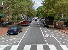 | Bike lanes are the most common type of bike-specific infrastructure in most cities. They are lanes painted onto a street that are designated for use by bicycles, but which are not physically protected from lanes used by cars. Most bike lanes are located on the extreme right of the through part of the street, but to the left of the parking lane or right-turn lane (if they are present). The most common type of bike lane is designated with white paint as shown in the picture, however some jurisdictions take the extra step of painting them green or blue at key locations in order to increase visibility. Another modification to the standard bike line is to add a painted buffer that increases the separation between bikes and cars. Painted or buffered bike lanes may be considered “enhanced.” On high-speed roadways shoulders are often used as minimal bike lanes. Photo by Google. |
Bike boulevard
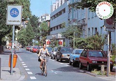 | Bike boulevards are streets specifically optimized for bikes through a variety of techniques, but on which cars are also permitted (though sometimes discouraged) to operate in mixed traffic. Optimization techniques are not standardized, but may include lane markings, chicanes (and other traffic calming measures), car access restrictions, bike-optimized intersection treatments, and any number of other potential enhancements. Although bike boulevards are technically mixed traffic streets, the degree of extra bike-specific infrastructure is considerably greater than on sharrow streets. Photo by “Fahrradstrasse – Radfaher sind hier tonangebend”. |
Sidepath
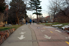 | Sidepaths are off-street bikeways that are built as extensions of the sidewalk. They provide complete physical separation from cars except at intersections with cross streets. Some sidepaths are shared with pedestrians, while others designate separation from pedestrians using paint or unique paving materials. Those that do are sometimes referred to as a subset of cycle tracks since they are intended to be exclusive to bikes, but they have a lesser degree of separation from pedestrians than true cycle tracks. Photo by BeyondDC. |
Cycle track
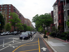 | In North American usage, cycle tracks are bikeways that are completely exclusive to bikes, physically separated from all other modes. The most common form is as an on-street bike lane placed between the curb and row of parked cars, but separation can also be obtained through other means such as bollards or additional curbs. Cycle tracks can come in many shapes and sizes, and are generally considered to be the pinnacle of street-adjacent bikeways. In Europe the term is more general and can be synonymous with bike lane. Photo by BeyondDC. |
Trail / shared-use path
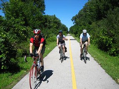 | Trails are dedicated car-free travelways that follow their own unique route. They are intended to be not only off-street, but to be completely free of any interaction with cars at all. Even street crossings are intended to be extremely rare, and ideally are grade separated. Most trails are technically shared-use paths, which means pedestrians are permitted to use them as well. Nevertheless the degree of separation from cars is so desirable that trails are generally considered to be superior to cycle tracks and all other forms of bike infrastructure. Photo by TouringCyclist. |
Of course the full gamut of bicycle infrastructure includes many other types of enhancements, such as bike boxes and bike stations, but these are the seven basic types of bicycle travelways available.

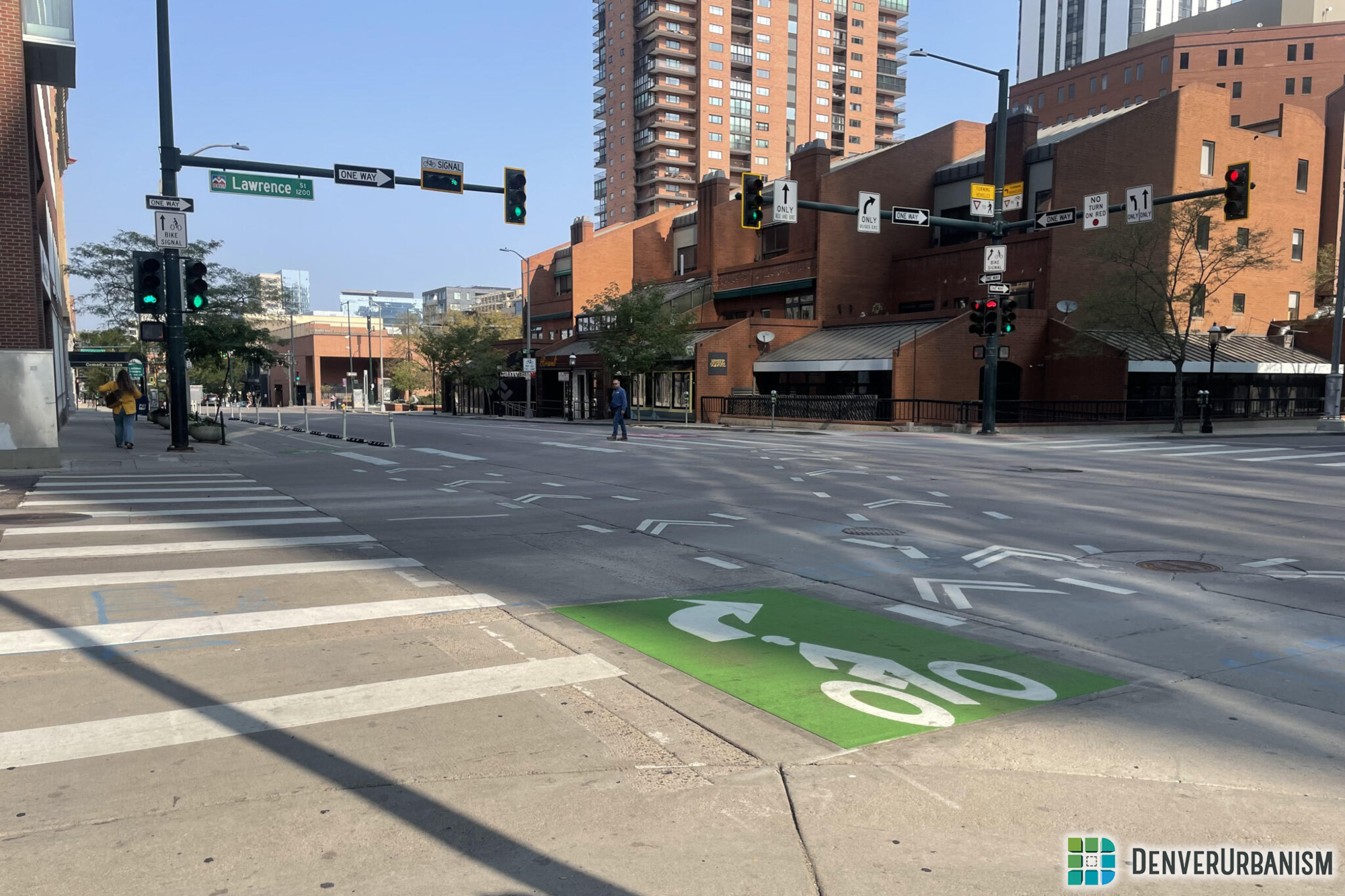




Excellent post. Which of these are we likely to see on 15th Street?
Chris, I believe the city is looking to do a painted buffered bike lane, similar to what was recently installed on Champa, with a longer-term option (pending funding) to upgrade it to a curb-protected lane (making it then into a cycle track type facility). However, the whole 15th Street bike facility issue is currently being studied by Public Works, so things may change. I’m sure our new bike blogger, John Hayden, could do a post soon on what’s planned for 15th.
Ken – When you say a painted buffered bike lane – do you mean painted lines? Or will the entire bike lane be painted? One of the best bike lane systems Ive ever come accross was in Sydney Austalia where their bike lanes (bike lanes & cycle track) were all painted green so it was easy to spot and gave the street a cool design element.
Perhaps Denver could explore doing the same thing with its bike lanes – even getting sponsorship from businesses / organizations and allowing them to paint logos or slogans (in addition to the bike lane symbols) in the lanes.
I live in a rural area in the Mountains of North Carolina and we have many twisty, narrow two-lane roads with narrow wooden and metal bridges that are designated bicycle routes or are popular with bicyclists. One road in particular is a very good ride, but you don’t know if somebody is going to come flying through at 60 MPH when the speed limit is 35 MPH and hit you on your bike. The main thoroughfare from the town I live in to the town with all the businesses has bike lanes along it added around 2005 and they are working on creating a greenway along the river and major creeks as well as several new-urbanist downtown areas.
Stellar site. Plenty of significant information here. I’m sending it to a few friends!
There was a lot here I didn’t know: sharrows, for example. We were just in Missoula, which is very bike-friendly and has the Missoula Institute for Sustainable Transportation.
Great article on infrastructure. Unfortunately it’s extremely difficult to read due to the layout of your web page. You get one and maybe two words across in the description column. With only four inches across for real content you are leaving 8 to 10 inches (depending on monitor width of white space! It would be sooo much easier to read if the caption was right below the photo and if you eliminated some of that empty and I would imagine costly real estate.