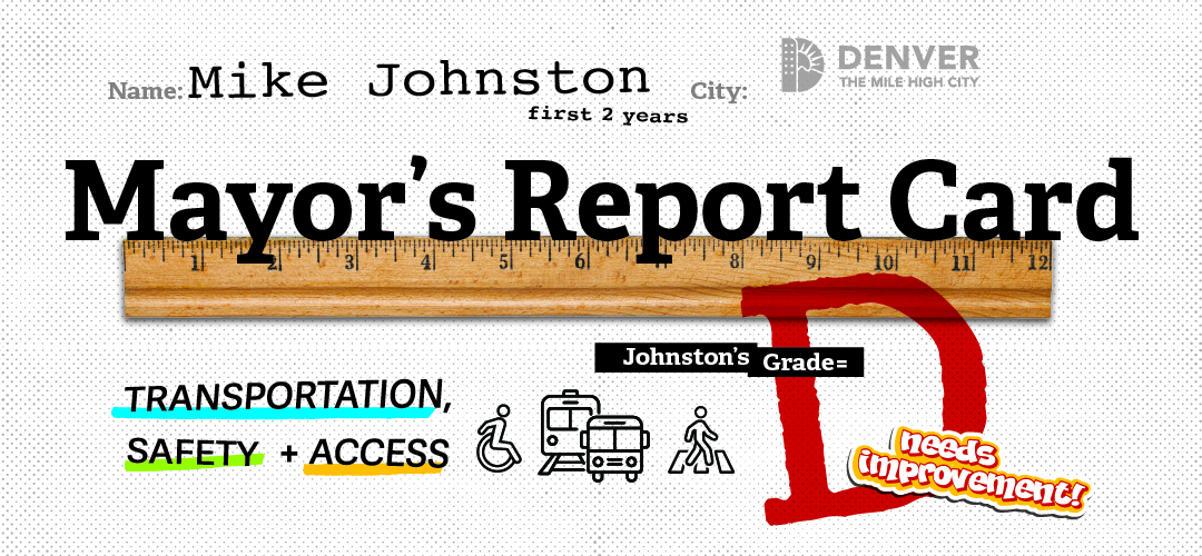
On March 11th, 2026 We Need Your Help!By Andy Cushen|2026-02-11T21:08:25-07:00February 11, 2026| Read More Comments Off on On March 11th, 2026 We Need Your Help!
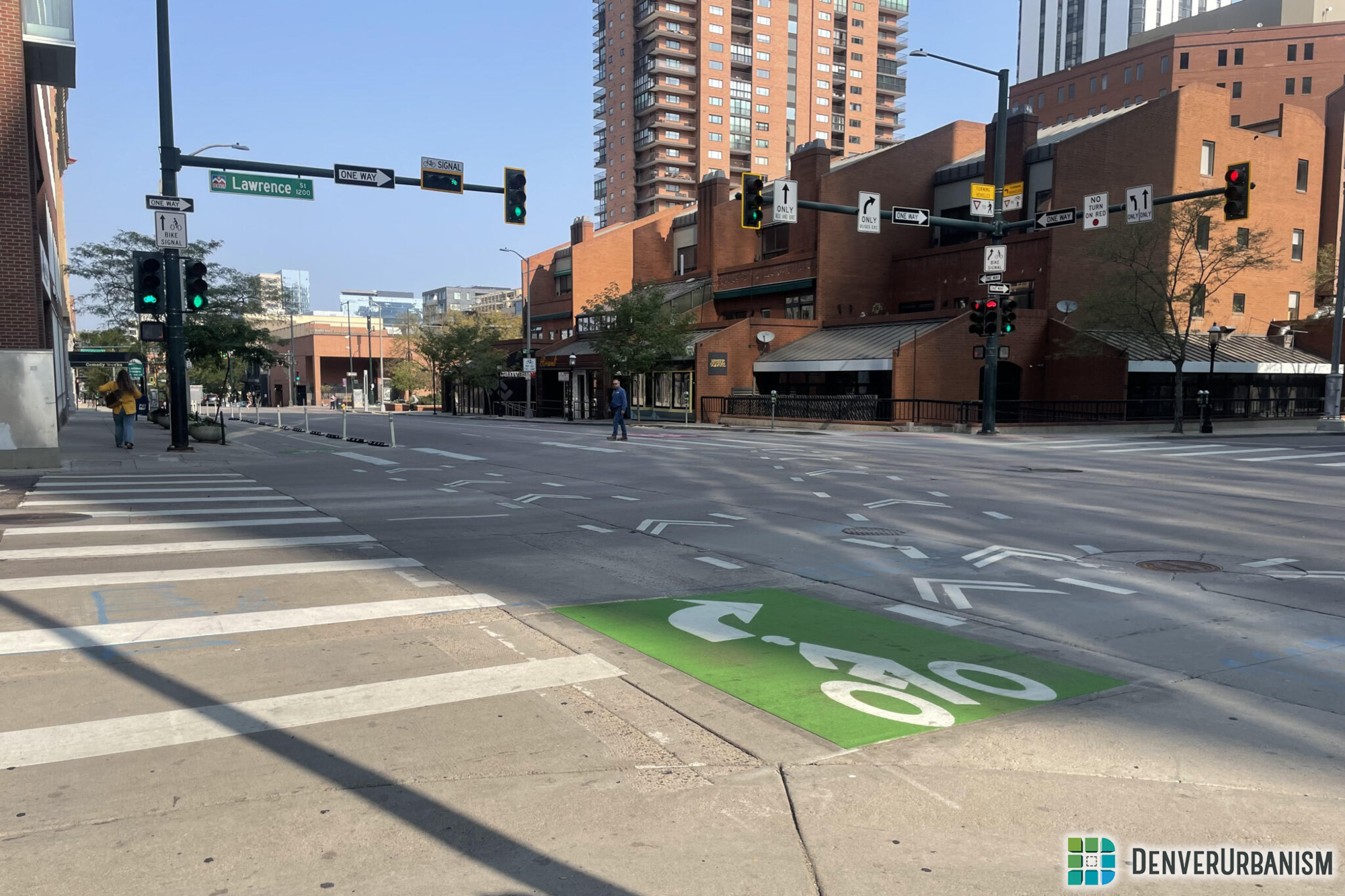
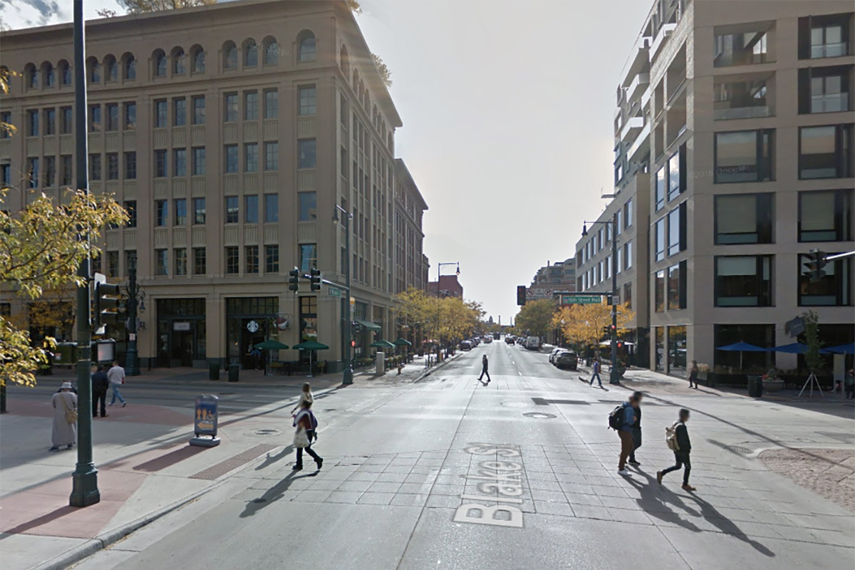
The Blake Triangle: Fixing One of Denver’s Nastiest Slip LanesBy Andy Cushen|2026-01-14T05:40:14-07:00November 7, 2025| Read More 2
In Defense of Flex Posts: The Aesthetic Benefits of Safe StreetsBy Andy Cushen|2026-01-03T13:54:35-07:00June 19, 2025| Read More 2
How Do I Meet the Director of Denver’s Streets? Protest!By Andy Cushen|2025-06-19T09:37:37-06:00May 24, 2025| Read More 2
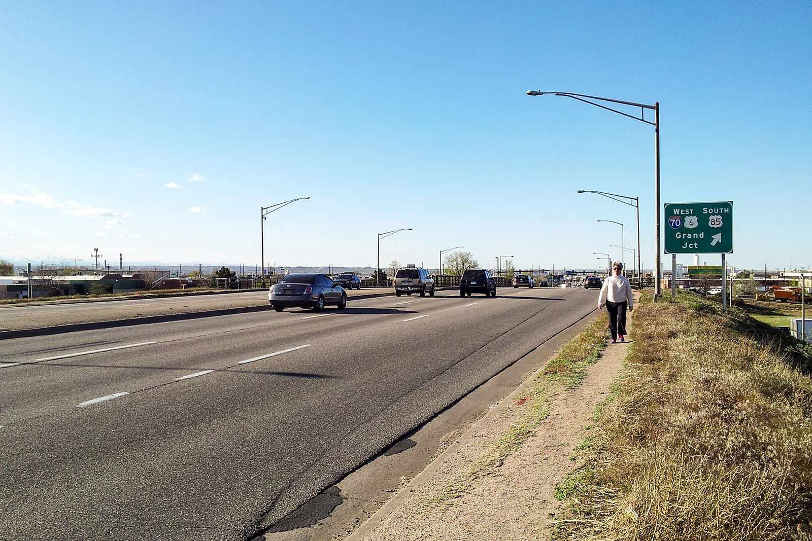
Transit Alternatives Must Be Studied before a Highway Expands in DenverBy Andy Cushen|2025-05-04T12:34:34-06:00March 3, 2025| Read More 4
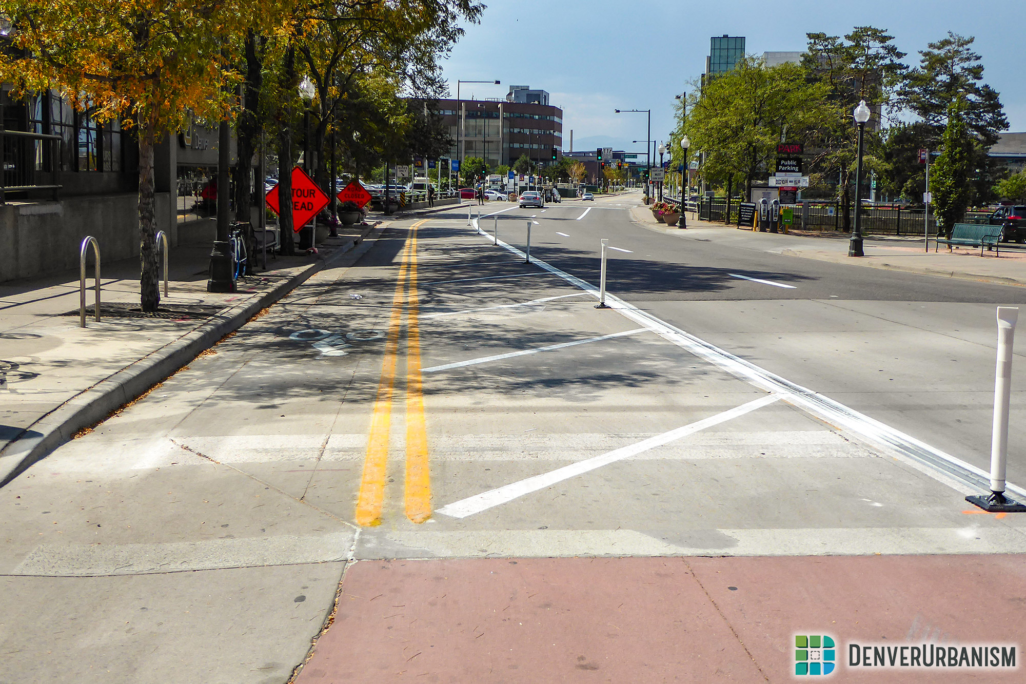
New Projects with Public Input along the Speer Triangles and NoNo StreetsBy Andy Cushen|2025-06-19T09:37:55-06:00February 11, 2025| Read More 3
Could the Golden Triangle Ever Be “Denver’s Manhattan”?By Andy Cushen|2025-03-03T20:18:56-07:00November 27, 2024| Read More 2
Bus Rapid Transit for People Who Aren’t on the BusBy Andy Cushen|2024-11-27T18:38:33-07:00November 18, 2024| Read More 2
DenverUrbanism Podcast 6 & 8: Vision Zero for Denver and its SuburbsBy Andy Cushen|2024-11-27T18:41:09-07:00September 9, 2024| Read More 1
DenverUrbanism Podcast Episode 4: Campaigning for a Livable Larimer StreetBy Andy Cushen|2024-07-06T12:51:00-06:00May 17, 2024| Read More Comments Off on DenverUrbanism Podcast Episode 4: Campaigning for a Livable Larimer Street
The Downtown Taco Bell is a Story of Urban Past and PresentBy Loren Hansen|2024-05-09T19:52:52-06:00April 30, 2024| Read More 1
Denver’s Most Urban Census Tracts and Urban NeighborhoodsBy Andy Cushen|2024-03-29T09:02:02-06:00March 15, 2024| Read More 1
East Colfax Avenue BRT and the Problems of Auto-Centric Land UseBy Andy Cushen|2024-01-20T11:24:06-07:00December 3, 2023| Read More 1
The Pedestrian Beg Button: Why is This Still a Thing?By Ryan Keeney|2019-08-18T14:36:02-06:00July 6, 2019| Read More 12
We Cleaned Up the High Line Canal Last Month—Here’s How It WentBy Loren Hansen|2018-10-30T14:33:07-06:00October 18, 2018| Read More Comments Off on We Cleaned Up the High Line Canal Last Month—Here’s How It Went
Not Everyone’s Commute Is a Hellish Automobile NightmareBy Ken Schroeppel|2018-09-17T20:06:21-06:00September 11, 2018| Read More 6
Let’s Clean Up the High Line Canal Trail in DenverBy Loren Hansen|2018-09-11T16:18:37-06:00September 7, 2018| Read More 1
New Free MallRide Stop Opens on Downtown’s 16th Street MallBy Ken Schroeppel|2018-09-07T03:23:33-06:00August 27, 2018| Read More 14
The “Last Mile” Isn’t Just a Transportation Problem but a Land Use One TooBy John Riecke|2018-08-21T12:10:53-06:00August 20, 2018| Read More 4
It Is Time to Start Making Denver a City of PedestriansBy John Riecke|2018-09-18T01:34:39-06:00November 19, 2017| Read More 11
Larimer Between 14th and Auraria Campus Receives Bike-Ped UpgradesBy Ken Schroeppel|2017-11-18T14:18:12-07:00September 10, 2017| Read More 7
Denver Post Fails to Imagine Denver as a City, Prefers Cowtown: Part 6By John Riecke|2017-03-22T23:14:01-06:00March 10, 2017| Read More 5
Denver Post Fails to Imagine Denver as a City, Prefers Cowtown: Part 5By John Riecke|2017-03-14T19:07:36-06:00March 9, 2017| Read More 3
Denver Post Fails to Imagine Denver as a City, Prefers Cowtown: Part 4By John Riecke|2017-03-14T19:07:27-06:00March 4, 2017| Read More 3
Denver Post Fails to Imagine Denver as a City, Prefers Cowtown: Part 3By John Riecke|2017-03-14T19:07:19-06:00March 4, 2017| Read More 3
Denver Post Fails to Imagine Denver as a City, Prefers Cowtown: Part 2By John Riecke|2017-03-14T19:07:11-06:00March 4, 2017| Read More 3
Denver Post Fails to Imagine Denver as a City, Prefers Cowtown: Part 1By John Riecke|2017-03-14T19:07:03-06:00March 4, 2017| Read More 11
Come Take a Ride on RTD’s Brand New R-Line!By Ryan Dravitz|2017-03-05T13:54:12-07:00March 3, 2017| Read More 2
Designing “Forgiving” Streets: There’s Nothing We Can Do. Or Is There?By Ken Schroeppel|2017-02-21T15:03:49-07:00February 11, 2017| Read More 2
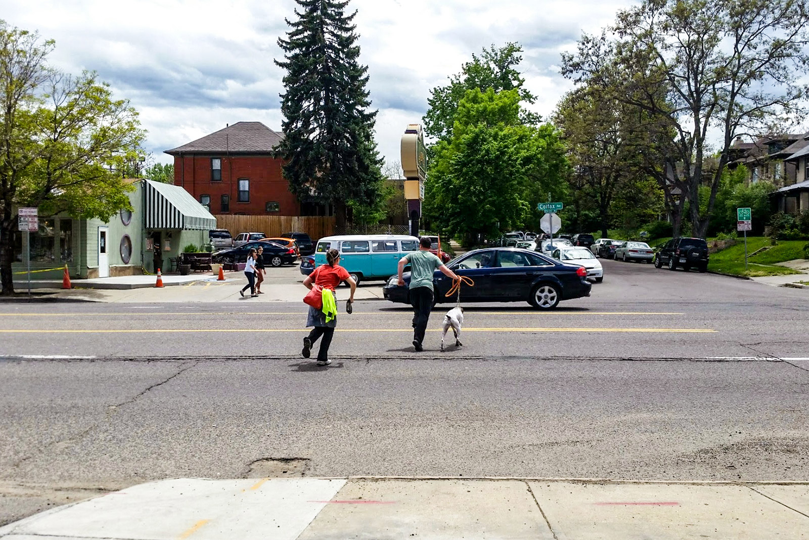
Walking in Denver Part 4: How Unsafe Streets Play Out at One IntersectionBy Ken Schroeppel|2016-12-22T17:52:07-07:00November 29, 2016| Read More 5